San Felipe Lachilló geodata
San Felipe Lachilló (Oaxaca) is a populated place; located in Mexico in America/Mexico_City (GMT-6) time zone. With population of 905 people, there are 9644 cities with bigger population in this country. Compared to other cities in Mexico, 97.2% of cities are located further ↑North; 81.6% of cities are located further ←West and 60.4% of cities have higher elevation than San Felipe Lachilló. Note1


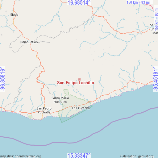
San Felipe Lachilló GPS coordinates[2]
16° 0' 37.62" North, 96° 9' 18.108" West
| Map corner | latitude | longitude |
|---|---|---|
| Upper-left | 16.68514°, | -96.85816° |
| Center: | 16.01045°, | -96.15503° |
| Lower-right: | 15.33347°, | -95.45191° |
| Map W x H: | 150.3×150.3 km | = 93.4×93.4mi |
| max Lat: | 32.7° ⇑97.2% North |
| San Felipe Lachilló: | 16.01045° |
| min Lat: | ⇓2.8% South 14.53588° |
| min Long | San Felipe Lach | max Long |
| -117.105° | -96.15503° | -86.73105° |
| W 81.6%⇐ | ⇒18.4% E |
Elevation
Elevation of San Felipe Lachilló is 974 m = 3196 ft, and this is 279.7 m = 918 ft below average elevation for this country.
| Max E: |
3497 m = 11473 ft | 60.4% |
| Avg. | 1253.7 m = 4113 ft | |
| San Felipe Lachilló | 974 m = 3196 ft | |
Min E: |
-1 m = -3 ft | 39.6% |
See also: Mexico elevation on elevation.city.
Geographical zone
San Felipe Lachilló is located in North Torrid zone (between Equator and Tropic of Cancer). Distance of this Northern Tropic circle is 825.7 km =513.1 mi to North.| Distance of | km | miles | from San Felipe Lachilló |
|---|---|---|---|
| North Pole | 8226.9 | 5112 | to North |
| Arctic Circle | 5621 | 3492.7 | to North |
| Tropic Cancer | 825.7 | 513.1 | to North |
| Equator | 1780.2 | 1106.2 | to South |


Nearby cities:
15 places around San Felipe Lachilló: (largest is in red/bold)
• Benito Juárez
23 km =14.3 mi,  231°
231°
• Merced del Potrero
9.9 km =6.2 mi,  65°
65°
• San Andrés Lovene
6.1 km =3.8 mi,  302°
302°
• San Francisco Ozolotepec
12.3 km =7.6 mi,  324°
324°
• San Gregorio Ozolotepec
23 km =14.3 mi,  305°
305°
• San Juan Guivini
10.8 km =6.7 mi,  337°
337°
• San Juan Ozolotepec
17.6 km =10.9 mi, 320°
• San Mateo Piñas
19.2 km =11.9 mi,  266°
266°
• San Miguel del Puerto
10.1 km =6.3 mi,  192°
192°
• Santa Cruz Ozolotepec
17.1 km =10.6 mi,  292°
292°
• Santa María Petatengo
15.1 km =9.4 mi,  107°
107°
• Santa María Xadani
11.1 km =6.9 mi,  128°
128°
• Santiago Lapaguía
14.4 km =8.9 mi, 344°
• Santiago Xanica
7.4 km =4.6 mi, 269°
• Santo Domingo Ozolotepec
22.7 km =14.1 mi, 313°
Sources, notices
• [Note1] Compared only with cities in Mexico existing in our database
• [Src1] Map data: © OpenStreetMap contributors (CC-BY-SA)
• [Src2] Other city data from geonames.org with taken over terms of usage.
• [Src3] Geographical zone / Annual Mean Temperature by Robert A. Rohde @ Wikipedia
