Santiago Lapaguía geodata
Santiago Lapaguía (Oaxaca) is a populated place; located in Mexico in America/Mexico_City (GMT-6) time zone. With population of 613 people, there are 14065 cities with bigger population in this country. Compared to other cities in Mexico, 96.7% of cities are located further ↑North; 81.4% of cities are located further ←West and 87.7% of cities have lower elevation than Santiago Lapaguía. Note1


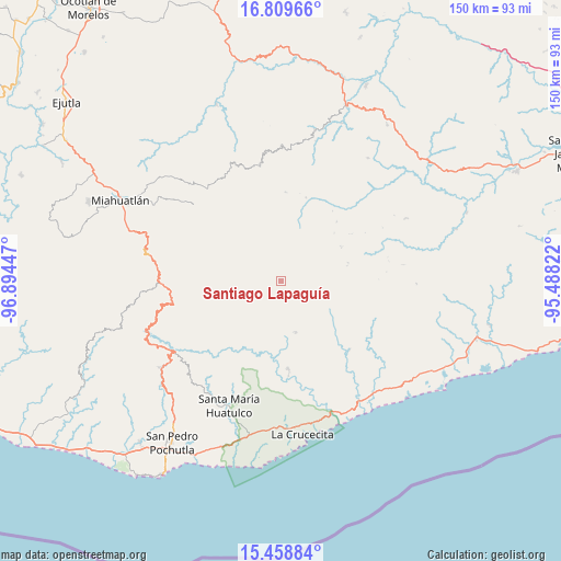
Santiago Lapaguía GPS coordinates[2]
16° 8' 7.44" North, 96° 11' 28.824" West
| Map corner | latitude | longitude |
|---|---|---|
| Upper-left | 16.80966°, | -96.89447° |
| Center: | 16.1354°, | -96.19134° |
| Lower-right: | 15.45884°, | -95.48822° |
| Map W x H: | 150.2×150.2 km | = 93.3×93.3mi |
| max Lat: | 32.7° ⇑96.7% North |
| Santiago Lapaguía: | 16.1354° |
| min Lat: | ⇓3.3% South 14.53588° |
| min Long | Santiago Lapagu | max Long |
| -117.105° | -96.19134° | -86.73105° |
| W 81.4%⇐ | ⇒18.6% E |
Elevation
Elevation of Santiago Lapaguía is 2331 m = 7648 ft, and this is 1077.3 m = 3534 ft above average elevation for this country.
| Max E: |
3497 m = 11473 ft | 12.3% |
| Santiago Lapaguía | 2331 m 7648 ft | |
| Avg. | 1253.7 m = 4113 ft | |
Min E: |
-1 m = -3 ft | 87.7% |
See also: Mexico elevation on elevation.city.
Geographical zone
Santiago Lapaguía is located in North Torrid zone (between Equator and Tropic of Cancer). Distance of this Northern Tropic circle is 811.8 km =504.4 mi to North.| Distance of | km | miles | from Santiago Lapaguía |
|---|---|---|---|
| North Pole | 8213 | 5103.3 | to North |
| Arctic Circle | 5607.1 | 3484.1 | to North |
| Tropic Cancer | 811.8 | 504.4 | to North |
| Equator | 1794.1 | 1114.8 | to South |


Nearby cities:
15 places around Santiago Lapaguía: (largest is in red/bold)
• Merced del Potrero
16.2 km =10.1 mi,  127°
127°
• San Andrés Lovene
10.7 km =6.6 mi,  186°
186°
• San Felipe Lachilló
14.4 km =8.9 mi,  164°
164°
• San Francisco Ozolotepec
5 km =3.1 mi,  220°
220°
• San Gregorio Ozolotepec
14.8 km =9.2 mi,  268°
268°
• San Juan Guivini
4 km =2.5 mi,  184°
184°
• San Juan Mixtepec
19.6 km =12.2 mi,  323°
323°
• San Juan Ozolotepec
7.3 km =4.5 mi, 268°
• San Mateo Piñas
21.4 km =13.3 mi,  225°
225°
• San Pablo Topiltepec
18.6 km =11.6 mi,  74°
74°
• San Pedro Mixtepec
18 km =11.2 mi,  326°
326°
• Santa Cruz Ozolotepec
13.9 km =8.6 mi,  238°
238°
• Santa María Ozolotepec
19.2 km =11.9 mi, 269°
• Santiago Xanica
14.4 km =8.9 mi, 194°
• Santo Domingo Ozolotepec
12.8 km =8 mi,  277°
277°
Sources, notices
• [Note1] Compared only with cities in Mexico existing in our database
• [Src1] Map data: © OpenStreetMap contributors (CC-BY-SA)
• [Src2] Other city data from geonames.org with taken over terms of usage.
• [Src3] Geographical zone / Annual Mean Temperature by Robert A. Rohde @ Wikipedia
