Lepan geodata
Lepan (Yucatán) is a populated place; located in Mexico in America/Merida (GMT-6) time zone. With population of 1,240 people, there are 6998 cities with bigger population in this country. Compared to other cities in Mexico, 71.9% of cities are located further ↓South; 98.1% of cities are located further ←West and 93% of cities have higher elevation than Lepan. Note1


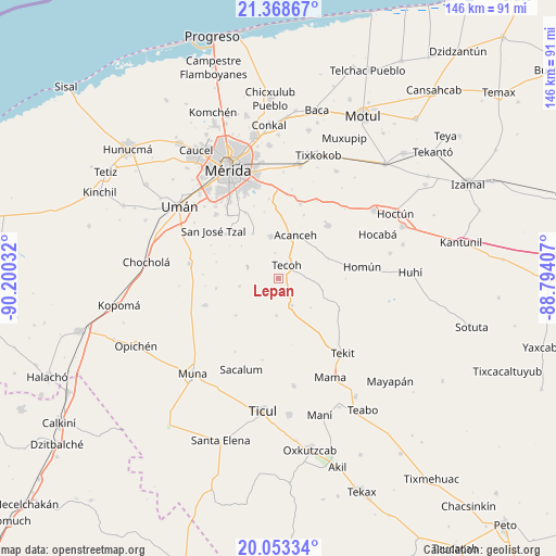
Lepan GPS coordinates[2]
20° 42' 44.748" North, 89° 29' 49.884" West
| Map corner | latitude | longitude |
|---|---|---|
| Upper-left | 21.36867°, | -90.20032° |
| Center: | 20.71243°, | -89.49719° |
| Lower-right: | 20.05334°, | -88.79407° |
| Map W x H: | 146.3×146.3 km | = 90.9×90.9mi |
| max Lat: | 32.7° ⇑28.1% North |
| Lepan: | 20.71243° |
| min Lat: | ⇓71.9% South 14.53588° |
| min Long | Lepan | max Long |
| -117.105° | -89.49719° | -86.73105° |
| W 98.1%⇐ | ⇒1.9% E |
Elevation
Elevation of Lepan is 17 m = 56 ft, and this is 1236.7 m = 4057 ft below average elevation for this country.
| Max E: |
3497 m = 11473 ft | 93% |
| Avg. | 1253.7 m = 4113 ft | |
| Lepan | 17 m = 56 ft | |
Min E: |
-1 m = -3 ft | 7% |
See also: Mexico elevation on elevation.city.
Geographical zone
Lepan is located in North Torrid zone (between Equator and Tropic of Cancer). Distance of this Northern Tropic circle is 302.9 km =188.2 mi to North.| Distance of | km | miles | from Lepan |
|---|---|---|---|
| North Pole | 7704.1 | 4787.1 | to North |
| Arctic Circle | 5098.2 | 3167.9 | to North |
| Tropic Cancer | 302.9 | 188.2 | to North |
| Equator | 2303 | 1431 | to South |


Nearby cities:
15 places around Lepan: (largest is in red/bold)
• Acanceh
12.1 km =7.5 mi,  22°
22°
• Canícab
17.8 km =11.1 mi, 22°
• Eknakan
14.2 km =8.8 mi,  69°
69°
• Molas
18 km =11.2 mi,  310°
310°
• Petectunich
14.6 km =9.1 mi,  8°
8°
• San Antonio Tzacalá
16.8 km =10.4 mi,  284°
284°
• San Isidro Ochil
18.2 km =11.3 mi,  117°
117°
• Subinkancab
17.6 km =10.9 mi,  348°
348°
• Tekik de Regil
13.4 km =8.3 mi,  330°
330°
• Tekoh
4.2 km =2.6 mi,  34°
34°
• Telchaquillo
8.1 km =5 mi,  154°
154°
• Temozon Sur
16.5 km =10.3 mi,  260°
260°
• Timucuy
11 km =6.8 mi, 350°
• Uayalceh de Peón
10.4 km =6.5 mi, 258°
• Yaxníc
15.3 km =9.5 mi,  304°
304°
Sources, notices
• [Note1] Compared only with cities in Mexico existing in our database
• [Src1] Map data: © OpenStreetMap contributors (CC-BY-SA)
• [Src2] Other city data from geonames.org with taken over terms of usage.
• [Src3] Geographical zone / Annual Mean Temperature by Robert A. Rohde @ Wikipedia
