Uayalceh de Peón geodata
Uayalceh de Peón (Yucatán) is a populated place; located in Mexico in America/Merida (GMT-6) time zone. With population of 2,323 people, there are 3801 cities with bigger population in this country. Compared to other cities in Mexico, 71.5% of cities are located further ↓South; 98% of cities are located further ←West and 92.5% of cities have higher elevation than Uayalceh de Peón. Note1


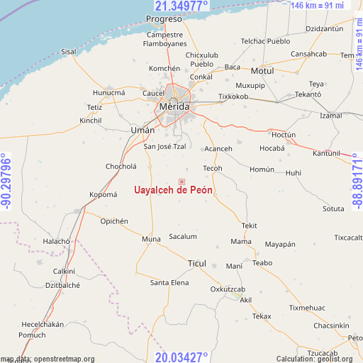
Uayalceh de Peón GPS coordinates[2]
20° 41' 36.42" North, 89° 35' 41.388" West
| Map corner | latitude | longitude |
|---|---|---|
| Upper-left | 21.34977°, | -90.29796° |
| Center: | 20.69345°, | -89.59483° |
| Lower-right: | 20.03427°, | -88.89171° |
| Map W x H: | 146.3×146.3 km | = 90.9×90.9mi |
| max Lat: | 32.7° ⇑28.5% North |
| Uayalceh de Peón: | 20.69345° |
| min Lat: | ⇓71.5% South 14.53588° |
| min Long | Uayalceh de Pe� | max Long |
| -117.105° | -89.59483° | -86.73105° |
| W 98%⇐ | ⇒2% E |
Elevation
Elevation of Uayalceh de Peón is 18 m = 59 ft, and this is 1235.7 m = 4054 ft below average elevation for this country.
| Max E: |
3497 m = 11473 ft | 92.5% |
| Avg. | 1253.7 m = 4113 ft | |
| Uayalceh de Peón | 18 m = 59 ft | |
Min E: |
-1 m = -3 ft | 7.5% |
See also: Mexico elevation on elevation.city.
Geographical zone
Uayalceh de Peón is located in North Torrid zone (between Equator and Tropic of Cancer). Distance of this Northern Tropic circle is 305 km =189.5 mi to North.| Distance of | km | miles | from Uayalceh de Peón |
|---|---|---|---|
| North Pole | 7706.2 | 4788.4 | to North |
| Arctic Circle | 5100.3 | 3169.2 | to North |
| Tropic Cancer | 305 | 189.5 | to North |
| Equator | 2300.9 | 1429.7 | to South |


Nearby cities:
15 places around Uayalceh de Peón: (largest is in red/bold)
• Abala
10.3 km =6.4 mi,  240°
240°
• Acanceh
19.8 km =12.3 mi,  48°
48°
• Lepan
10.4 km =6.5 mi,  78°
78°
• Molas
14.2 km =8.8 mi,  345°
345°
• San Antonio Tzacalá
8.8 km =5.5 mi,  315°
315°
• San José Tzal
16.1 km =10 mi,  334°
334°
• San Pedro Chimay
19.1 km =11.9 mi,  4°
4°
• Tekik de Regil
14.1 km =8.8 mi,  14°
14°
• Tekoh
13.7 km =8.5 mi,  66°
66°
• Telchaquillo
14.6 km =9.1 mi,  110°
110°
• Temozon Sur
6.1 km =3.8 mi,  263°
263°
• Timucuy
15.5 km =9.6 mi,  32°
32°
• Xmatkuíl
18.8 km =11.7 mi, 350°
• Yaxcopoil
14.4 km =8.9 mi,  293°
293°
• Yaxníc
11 km =6.8 mi, 346°
Sources, notices
• [Note1] Compared only with cities in Mexico existing in our database
• [Src1] Map data: © OpenStreetMap contributors (CC-BY-SA)
• [Src2] Other city data from geonames.org with taken over terms of usage.
• [Src3] Geographical zone / Annual Mean Temperature by Robert A. Rohde @ Wikipedia
