La Joya geodata
La Joya (Chiapas) is a populated place; located in Mexico in America/Mexico_City (GMT-6) time zone. With population of 683 people, there are 12712 cities with bigger population in this country. Compared to other cities in Mexico, 99.7% of cities are located further ↑North; 93.7% of cities are located further ←West and 78.9% of cities have higher elevation than La Joya. Note1


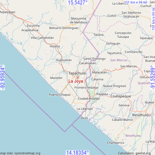
La Joya GPS coordinates[2]
14° 51' 51.084" North, 92° 15' 21.996" West
| Map corner | latitude | longitude |
|---|---|---|
| Upper-left | 15.5427°, | -92.95924° |
| Center: | 14.86419°, | -92.25611° |
| Lower-right: | 14.18354°, | -91.55299° |
| Map W x H: | 151.1×151.1 km | = 93.9×93.9mi |
| max Lat: | 32.7° ⇑99.7% North |
| La Joya: | 14.86419° |
| min Lat: | ⇓0.3% South 14.53588° |
| min Long | La Joya | max Long |
| -117.105° | -92.25611° | -86.73105° |
| W 93.7%⇐ | ⇒6.3% E |
Elevation
Elevation of La Joya is 114 m = 374 ft, and this is 1139.7 m = 3739 ft below average elevation for this country.
| Max E: |
3497 m = 11473 ft | 78.9% |
| Avg. | 1253.7 m = 4113 ft | |
| La Joya | 114 m = 374 ft | |
Min E: |
-1 m = -3 ft | 21.1% |
See also: Mexico elevation on elevation.city.
Geographical zone
La Joya is located in North Torrid zone (between Equator and Tropic of Cancer). Distance of this Northern Tropic circle is 953.2 km =592.3 mi to North.| Distance of | km | miles | from La Joya |
|---|---|---|---|
| North Pole | 8354.3 | 5191.1 | to North |
| Arctic Circle | 5748.4 | 3571.9 | to North |
| Tropic Cancer | 953.2 | 592.3 | to North |
| Equator | 1652.7 | 1026.9 | to South |


Nearby cities:
15 places around La Joya: (largest is in red/bold)
• Cebadilla 1ra. Sección
2.5 km =1.6 mi,  269°
269°
• El Sacrificio
3.2 km =2 mi,  72°
72°
• Guadalupe Victoria
6.7 km =4.2 mi,  175°
175°
• Las Palmeras
2.1 km =1.3 mi,  278°
278°
• Llano de la Lima
4.4 km =2.7 mi, 272°
• Los Cafetales
4.9 km =3 mi, 274°
• Los Encinos
2.9 km =1.8 mi,  42°
42°
• Los Palacios
0.8 km =0.5 mi,  196°
196°
• Murillo
6.8 km =4.2 mi,  217°
217°
• Octavio Paz
1.1 km =0.7 mi,  229°
229°
• Omoa
4.3 km =2.7 mi,  144°
144°
• Raymundo Enríquez
6.3 km =3.9 mi, 273°
• Tapachula
4.4 km =2.7 mi,  358°
358°
• Vicente Guerrero
5.4 km =3.4 mi,  98°
98°
• Vida Mejor I
5.6 km =3.5 mi, 276°
Sources, notices
• [Note1] Compared only with cities in Mexico existing in our database
• [Src1] Map data: © OpenStreetMap contributors (CC-BY-SA)
• [Src2] Other city data from geonames.org with taken over terms of usage.
• [Src3] Geographical zone / Annual Mean Temperature by Robert A. Rohde @ Wikipedia
