Jonotal Azteca geodata
Jonotal Azteca (Veracruz) is a populated place; located in Mexico in America/Mexico_City (GMT-6) time zone. With population of 829 people, there are 10549 cities with bigger population in this country. Compared to other cities in Mexico, 71.3% of cities are located further ↓South; 62.4% of cities are located further ←West and 75.5% of cities have higher elevation than Jonotal Azteca. Note1


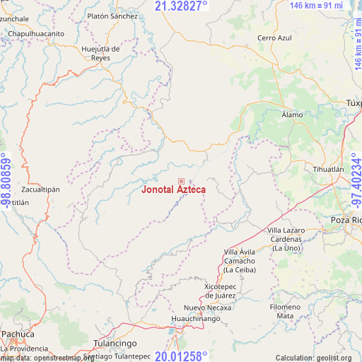
Jonotal Azteca GPS coordinates[2]
20° 40' 18.66" North, 98° 6' 19.656" West
| Map corner | latitude | longitude |
|---|---|---|
| Upper-left | 21.32827°, | -98.80859° |
| Center: | 20.67185°, | -98.10546° |
| Lower-right: | 20.01258°, | -97.40234° |
| Map W x H: | 146.3×146.3 km | = 90.9×90.9mi |
| max Lat: | 32.7° ⇑28.7% North |
| Jonotal Azteca: | 20.67185° |
| min Lat: | ⇓71.3% South 14.53588° |
| min Long | Jonotal Azteca | max Long |
| -117.105° | -98.10546° | -86.73105° |
| W 62.4%⇐ | ⇒37.6% E |
Elevation
Elevation of Jonotal Azteca is 206 m = 676 ft, and this is 1047.7 m = 3437 ft below average elevation for this country.
| Max E: |
3497 m = 11473 ft | 75.5% |
| Avg. | 1253.7 m = 4113 ft | |
| Jonotal Azteca | 206 m = 676 ft | |
Min E: |
-1 m = -3 ft | 24.5% |
See also: Mexico elevation on elevation.city.
Geographical zone
Jonotal Azteca is located in North Torrid zone (between Equator and Tropic of Cancer). Distance of this Northern Tropic circle is 307.4 km =191 mi to North.| Distance of | km | miles | from Jonotal Azteca |
|---|---|---|---|
| North Pole | 7708.6 | 4789.9 | to North |
| Arctic Circle | 5102.7 | 3170.7 | to North |
| Tropic Cancer | 307.4 | 191 | to North |
| Equator | 2298.5 | 1428.2 | to South |


Nearby cities:
15 places around Jonotal Azteca: (largest is in red/bold)
• Chintipán
8.4 km =5.2 mi,  260°
260°
• El Naranjal
8.9 km =5.5 mi,  316°
316°
• El Tizán
10.8 km =6.7 mi,  21°
21°
• El Zapote Bravo
11.1 km =6.9 mi,  95°
95°
• Huexotitla
11 km =6.8 mi,  9°
9°
• Ixhuatlán de Madero
9.9 km =6.2 mi,  79°
79°
• Joya Chica
11.9 km =7.4 mi,  68°
68°
• Juntas Chicas
13.4 km =8.3 mi,  144°
144°
• Otatitlán
5.4 km =3.4 mi,  221°
221°
• Pilpuerta
12.2 km =7.6 mi,  353°
353°
• Puyecaco
11.3 km =7 mi,  34°
34°
• San Lorenzo Achiotepec
9.1 km =5.7 mi,  155°
155°
• Tenantitla
11.7 km =7.3 mi,  339°
339°
• Tierra Colorada
10.4 km =6.5 mi,  250°
250°
• Tlachichilco
11.2 km =7 mi,  239°
239°
Sources, notices
• [Note1] Compared only with cities in Mexico existing in our database
• [Src1] Map data: © OpenStreetMap contributors (CC-BY-SA)
• [Src2] Other city data from geonames.org with taken over terms of usage.
• [Src3] Geographical zone / Annual Mean Temperature by Robert A. Rohde @ Wikipedia
