San Lorenzo Achiotepec geodata
San Lorenzo Achiotepec (Hidalgo) is a populated place; located in Mexico in America/Mexico_City (GMT-6) time zone. With population of 1,746 people, there are 4971 cities with bigger population in this country. Compared to other cities in Mexico, 69.9% of cities are located further ↓South; 62.8% of cities are located further ←West and 67.7% of cities have higher elevation than San Lorenzo Achiotepec. Note1
Current local time in San Lorenzo Achiotepec:
08:29 AM, WednesdayDifference from your time zone: hours


San Lorenzo Achiotepec GPS coordinates[2]
20° 35' 50.352" North, 98° 4' 7.536" West
| Map corner | latitude | longitude |
|---|---|---|
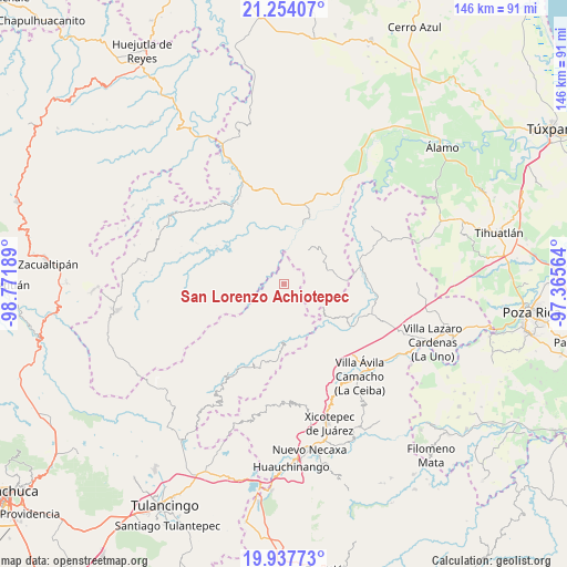
| Upper-left | 21.25407°, | -98.77189° |
| Center: | 20.59732°, | -98.06876° |
| Lower-right: | 19.93773°, | -97.36564° |
| Map W x H: | 146.4×146.4 km | = 91×91mi |
| max Lat: | 32.7° ⇑30.1% North |
| San Lorenzo Achiotepec: | 20.59732° |
| min Lat: | ⇓69.9% South 14.53588° |
| min Long | San Lorenzo Ach | max Long |
| -117.105° | -98.06876° | -86.73105° |
| W 62.8%⇐ | ⇒37.2% E |
Elevation
Elevation of San Lorenzo Achiotepec is 542 m = 1778 ft, and this is 711.7 m = 2335 ft below average elevation for this country.
| Max E: |
3497 m = 11473 ft | 67.7% |
| Avg. | 1253.7 m = 4113 ft | |
| San Lorenzo Achiotepec | 542 m = 1778 ft | |
Min E: |
-1 m = -3 ft | 32.3% |
See also: Mexico elevation on elevation.city.
Geographical zone
San Lorenzo Achiotepec is located in North Torrid zone (between Equator and Tropic of Cancer). Distance of this Northern Tropic circle is 315.7 km =196.2 mi to North.| Distance of | km | miles | from San Lorenzo Achiotepec |
|---|---|---|---|
| North Pole | 7716.9 | 4795.1 | to North |
| Arctic Circle | 5111 | 3175.8 | to North |
| Tropic Cancer | 315.7 | 196.2 | to North |
| Equator | 2290.2 | 1423.1 | to South |


Nearby cities:
15 places around San Lorenzo Achiotepec: (largest is in red/bold)
• Acuautla
12.5 km =7.8 mi,  163°
163°
• Chintipán
14 km =8.7 mi,  299°
299°
• El Pozo
13.6 km =8.5 mi,  132°
132°
• El Zapote Bravo
10.2 km =6.3 mi,  45°
45°
• Ixhuatlán de Madero
11.8 km =7.3 mi,  30°
30°
• Ixtololoya
13.5 km =8.4 mi, 127°
• Jonotal Azteca
9.1 km =5.7 mi,  335°
335°
• Juntas Chicas
4.7 km =2.9 mi,  123°
123°
• Otatitlán
8.5 km =5.3 mi, 299°
• San Ambrosio
9.1 km =5.7 mi,  147°
147°
• San Andrés
10.9 km =6.8 mi,  195°
195°
• San Esteban
5.9 km =3.7 mi,  171°
171°
• San Francisco
8.5 km =5.3 mi, 125°
• San Gregorio
12.2 km =7.6 mi, 154°
• Tlachichilco
13.8 km =8.6 mi,  281°
281°
Sources, notices
• [Note1] Compared only with cities in Mexico existing in our database
• [Src1] Map data: © OpenStreetMap contributors (CC-BY-SA)
• [Src2] Other city data from geonames.org with taken over terms of usage.
• [Src3] Geographical zone / Annual Mean Temperature by Robert A. Rohde @ Wikipedia
