Tenantitla geodata
Tenantitla (Veracruz) is a populated place; located in Mexico in America/Mexico_City (GMT-6) time zone. With population of 1,273 people, there are 6805 cities with bigger population in this country. Compared to other cities in Mexico, 72.8% of cities are located further ↓South; 62% of cities are located further ←West and 72.1% of cities have higher elevation than Tenantitla. Note1


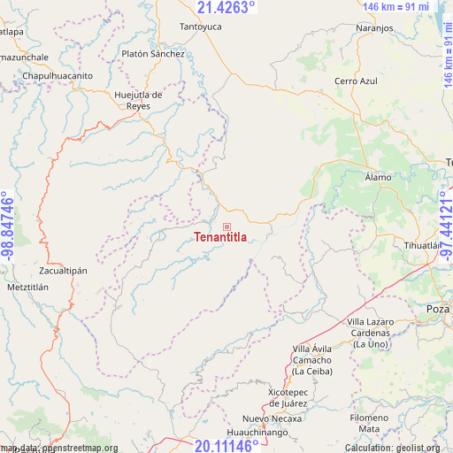
Tenantitla GPS coordinates[2]
20° 46' 13.116" North, 98° 8' 39.588" West
| Map corner | latitude | longitude |
|---|---|---|
| Upper-left | 21.4263°, | -98.84746° |
| Center: | 20.77031°, | -98.14433° |
| Lower-right: | 20.11146°, | -97.44121° |
| Map W x H: | 146.2×146.2 km | = 90.8×90.8mi |
| max Lat: | 32.7° ⇑27.2% North |
| Tenantitla: | 20.77031° |
| min Lat: | ⇓72.8% South 14.53588° |
| min Long | Tenantitla | max Long |
| -117.105° | -98.14433° | -86.73105° |
| W 62%⇐ | ⇒38% E |
Elevation
Elevation of Tenantitla is 326 m = 1070 ft, and this is 927.7 m = 3044 ft below average elevation for this country.
| Max E: |
3497 m = 11473 ft | 72.1% |
| Avg. | 1253.7 m = 4113 ft | |
| Tenantitla | 326 m = 1070 ft | |
Min E: |
-1 m = -3 ft | 27.9% |
See also: Mexico elevation on elevation.city.
Geographical zone
Tenantitla is located in North Torrid zone (between Equator and Tropic of Cancer). Distance of this Northern Tropic circle is 296.5 km =184.2 mi to North.| Distance of | km | miles | from Tenantitla |
|---|---|---|---|
| North Pole | 7697.6 | 4783.1 | to North |
| Arctic Circle | 5091.7 | 3163.8 | to North |
| Tropic Cancer | 296.5 | 184.2 | to North |
| Equator | 2309.4 | 1435 | to South |


Nearby cities:
15 places around Tenantitla: (largest is in red/bold)
• Cacahuatengo
11 km =6.8 mi,  81°
81°
• Colatlán
7.1 km =4.4 mi,  43°
43°
• El Naranjal
5 km =3.1 mi,  205°
205°
• El Tizán
8 km =5 mi,  96°
96°
• Huexotitla
5.8 km =3.6 mi,  90°
90°
• Hueycuatitla
11.3 km =7 mi,  343°
343°
• La Reforma
5.1 km =3.2 mi,  358°
358°
• Limontitla
10.1 km =6.3 mi,  248°
248°
• Otlamalacatl
10.8 km =6.7 mi,  310°
310°
• Otlatzintla
10.9 km =6.8 mi,  275°
275°
• Palma Real
4.1 km =2.5 mi,  13°
13°
• Piedra Grande
10.6 km =6.6 mi, 83°
• Pilpuerta
2.9 km =1.8 mi,  66°
66°
• Primo Verdad
9.3 km =5.8 mi, 307°
• Puyecaco
10.6 km =6.6 mi, 99°
Sources, notices
• [Note1] Compared only with cities in Mexico existing in our database
• [Src1] Map data: © OpenStreetMap contributors (CC-BY-SA)
• [Src2] Other city data from geonames.org with taken over terms of usage.
• [Src3] Geographical zone / Annual Mean Temperature by Robert A. Rohde @ Wikipedia
