Ignacio Ramírez geodata
Ignacio Ramírez (Puebla) is a populated place; located in Mexico in America/Mexico_City (GMT-6) time zone. With population of 596 people, there are 14429 cities with bigger population in this country. Compared to other cities in Mexico, 59.4% of cities are located further ↓South; 66.9% of cities are located further ←West and 64.2% of cities have higher elevation than Ignacio Ramírez. Note1


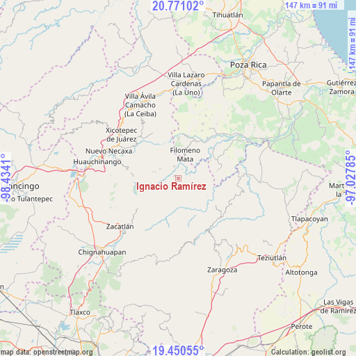
Ignacio Ramírez GPS coordinates[2]
20° 6' 43.848" North, 97° 43' 51.492" West
| Map corner | latitude | longitude |
|---|---|---|
| Upper-left | 20.77102°, | -98.4341° |
| Center: | 20.11218°, | -97.73097° |
| Lower-right: | 19.45055°, | -97.02785° |
| Map W x H: | 146.8×146.8 km | = 91.2×91.2mi |
| max Lat: | 32.7° ⇑40.6% North |
| Ignacio Ramírez: | 20.11218° |
| min Lat: | ⇓59.4% South 14.53588° |
| min Long | Ignacio Ramíre | max Long |
| -117.105° | -97.73097° | -86.73105° |
| W 66.9%⇐ | ⇒33.1% E |
Elevation
Elevation of Ignacio Ramírez is 737 m = 2418 ft, and this is 516.7 m = 1695 ft below average elevation for this country.
| Max E: |
3497 m = 11473 ft | 64.2% |
| Avg. | 1253.7 m = 4113 ft | |
| Ignacio Ramírez | 737 m = 2418 ft | |
Min E: |
-1 m = -3 ft | 35.8% |
See also: Mexico elevation on elevation.city.
Geographical zone
Ignacio Ramírez is located in North Torrid zone (between Equator and Tropic of Cancer). Distance of this Northern Tropic circle is 369.7 km =229.7 mi to North.| Distance of | km | miles | from Ignacio Ramírez |
|---|---|---|---|
| North Pole | 7770.8 | 4828.5 | to North |
| Arctic Circle | 5164.9 | 3209.3 | to North |
| Tropic Cancer | 369.7 | 229.7 | to North |
| Equator | 2236.3 | 1389.6 | to South |


Nearby cities:
15 places around Ignacio Ramírez: (largest is in red/bold)
• Altica
7.9 km =4.9 mi,  249°
249°
• Bibiano Hernández
4.7 km =2.9 mi,  132°
132°
• Bienvenido
1.8 km =1.1 mi,  309°
309°
• Buenos Aires
4.9 km =3 mi,  338°
338°
• Bugambilias (La Cruz)
7.7 km =4.8 mi,  27°
27°
• Chipahuatlán
7.2 km =4.5 mi,  142°
142°
• Coatepec
5.7 km =3.5 mi,  180°
180°
• Coyay
4 km =2.5 mi,  218°
218°
• Francisco Osorno
4 km =2.5 mi,  23°
23°
• Jojupango (San Miguel Jojupango)
4.6 km =2.9 mi, 247°
• Jopala
7 km =4.3 mi, 34°
• Olintla
5 km =3.1 mi,  103°
103°
• San Martín del Progreso (La Punta)
5.3 km =3.3 mi,  285°
285°
• Vicente Guerrero
8.1 km =5 mi,  81°
81°
• África
4.9 km =3 mi, 307°
Sources, notices
• [Note1] Compared only with cities in Mexico existing in our database
• [Src1] Map data: © OpenStreetMap contributors (CC-BY-SA)
• [Src2] Other city data from geonames.org with taken over terms of usage.
• [Src3] Geographical zone / Annual Mean Temperature by Robert A. Rohde @ Wikipedia
