África geodata
África (Puebla) is a populated place; located in Mexico in America/Mexico_City (GMT-6) time zone. With population of 643 people, there are 13457 cities with bigger population in this country. Compared to other cities in Mexico, 60% of cities are located further ↓South; 66.5% of cities are located further ←West and 63.4% of cities have higher elevation than África. Note1


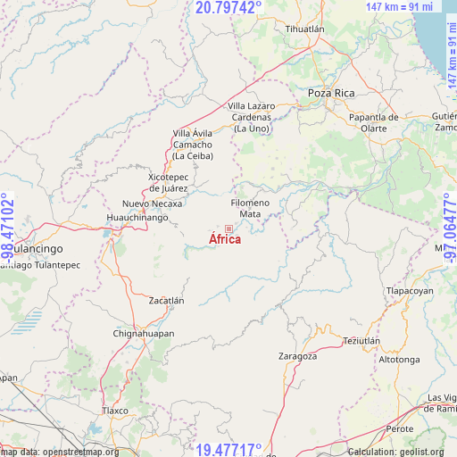
África GPS coordinates[2]
20° 8' 19.284" North, 97° 46' 4.404" West
| Map corner | latitude | longitude |
|---|---|---|
| Upper-left | 20.79742°, | -98.47102° |
| Center: | 20.13869°, | -97.76789° |
| Lower-right: | 19.47717°, | -97.06477° |
| Map W x H: | 146.8×146.8 km | = 91.2×91.2mi |
| max Lat: | 32.7° ⇑40% North |
| África: | 20.13869° |
| min Lat: | ⇓60% South 14.53588° |
| min Long | África | max Long |
| -117.105° | -97.76789° | -86.73105° |
| W 66.5%⇐ | ⇒33.5% E |
Elevation
Elevation of África is 791 m = 2595 ft, and this is 462.7 m = 1518 ft below average elevation for this country.
| Max E: |
3497 m = 11473 ft | 63.4% |
| Avg. | 1253.7 m = 4113 ft | |
| África | 791 m = 2595 ft | |
Min E: |
-1 m = -3 ft | 36.6% |
See also: Mexico elevation on elevation.city.
Geographical zone
África is located in North Torrid zone (between Equator and Tropic of Cancer). Distance of this Northern Tropic circle is 366.7 km =227.9 mi to North.| Distance of | km | miles | from África |
|---|---|---|---|
| North Pole | 7767.8 | 4826.7 | to North |
| Arctic Circle | 5162 | 3207.5 | to North |
| Tropic Cancer | 366.7 | 227.9 | to North |
| Equator | 2239.2 | 1391.4 | to South |


Nearby cities:
15 places around África: (largest is in red/bold)
• Ahuacatlaya
7.6 km =4.7 mi,  305°
305°
• Altica
6.7 km =4.2 mi,  212°
212°
• Bienvenido
3.1 km =1.9 mi,  126°
126°
• Buenos Aires
2.6 km =1.6 mi,  51°
51°
• Bugambilias (La Cruz)
8.3 km =5.2 mi,  62°
62°
• Coyay
6.2 km =3.9 mi,  167°
167°
• Cuautotola
8.4 km =5.2 mi,  201°
201°
• Francisco Osorno
5.5 km =3.4 mi,  82°
82°
• Ignacio Ramírez
4.9 km =3 mi, 127°
• Jojupango (San Miguel Jojupango)
4.7 km =2.9 mi,  185°
185°
• Jopala
8.3 km =5.2 mi,  70°
70°
• La Cruz
5.3 km =3.3 mi,  266°
266°
• San Martín del Progreso (La Punta)
2 km =1.2 mi,  218°
218°
• Tlamaya Chico
6.4 km =4 mi, 266°
• Tlamaya Grande
3.8 km =2.4 mi,  283°
283°
Sources, notices
• [Note1] Compared only with cities in Mexico existing in our database
• [Src1] Map data: © OpenStreetMap contributors (CC-BY-SA)
• [Src2] Other city data from geonames.org with taken over terms of usage.
• [Src3] Geographical zone / Annual Mean Temperature by Robert A. Rohde @ Wikipedia
