San Martín del Progreso (La Punta) geodata
San Martín del Progreso (La Punta) (Puebla) is a populated place; located in Mexico in America/Mexico_City (GMT-6) time zone. With population of 502 people, there are 16762 cities with bigger population in this country. Compared to other cities in Mexico, 59.7% of cities are located further ↓South; 66.4% of cities are located further ←West and 63.9% of cities have higher elevation than San Martín del Progreso (La Punta). Note1
Current local time in San Martín del Progreso (La Punta):
10:25 AM, MondayDifference from your time zone: hours


San Martín del Progreso (La Punta) GPS coordinates[2]
20° 7' 28.56" North, 97° 46' 48.072" West
| Map corner | latitude | longitude |
|---|---|---|
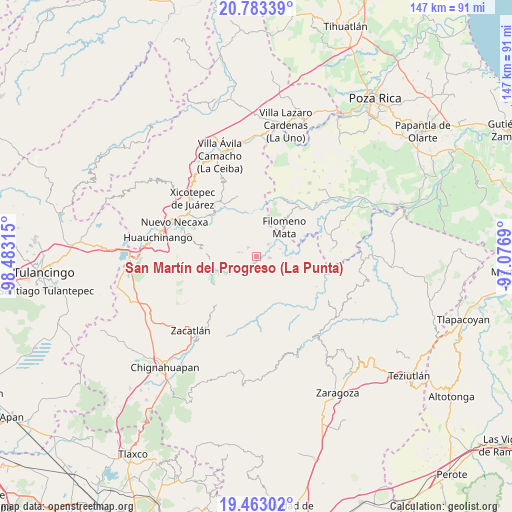
| Upper-left | 20.78339°, | -98.48315° |
| Center: | 20.1246°, | -97.78002° |
| Lower-right: | 19.46302°, | -97.0769° |
| Map W x H: | 146.8×146.8 km | = 91.2×91.2mi |
| max Lat: | 32.7° ⇑40.3% North |
| San Martín del Progreso (La Punta): | 20.1246° |
| min Lat: | ⇓59.7% South 14.53588° |
| min Long | San Martín del | max Long |
| -117.105° | -97.78002° | -86.73105° |
| W 66.4%⇐ | ⇒33.6% E |
Elevation
Elevation of San Martín del Progreso (La Punta) is 755 m = 2477 ft, and this is 498.7 m = 1636 ft below average elevation for this country.
| Max E: |
3497 m = 11473 ft | 63.9% |
| Avg. | 1253.7 m = 4113 ft | |
| San Martín del Progreso (La Punta) | 755 m = 2477 ft | |
Min E: |
-1 m = -3 ft | 36.1% |
See also: Mexico elevation on elevation.city.
Geographical zone
San Martín del Progreso (La Punta) is located in North Torrid zone (between Equator and Tropic of Cancer). Distance of this Northern Tropic circle is 368.3 km =228.9 mi to North.| Distance of | km | miles | from San Martín del Progreso (La Punta) |
|---|---|---|---|
| North Pole | 7769.4 | 4827.7 | to North |
| Arctic Circle | 5163.5 | 3208.4 | to North |
| Tropic Cancer | 368.3 | 228.9 | to North |
| Equator | 2237.6 | 1390.4 | to South |


Nearby cities:
15 places around San Martín del Progreso (La Punta): (largest is in red/bold)
• Ahuacatlaya
7.8 km =4.8 mi,  320°
320°
• Altica
4.7 km =2.9 mi,  209°
209°
• Bienvenido
3.7 km =2.3 mi,  93°
93°
• Buenos Aires
4.6 km =2.9 mi,  46°
46°
• Coyay
5.2 km =3.2 mi,  150°
150°
• Cuautotola
6.5 km =4 mi,  196°
196°
• Francisco Osorno
7.1 km =4.4 mi,  71°
71°
• Ignacio Ramírez
5.3 km =3.3 mi,  105°
105°
• Jojupango (San Miguel Jojupango)
3.2 km =2 mi,  165°
165°
• La Cruz
4.2 km =2.6 mi,  286°
286°
• La Cumbre
7.7 km =4.8 mi,  265°
265°
• Tlamaya Chico
5.2 km =3.2 mi,  282°
282°
• Tlamaya Grande
3.5 km =2.2 mi, 315°
• Tlapacoya
7.4 km =4.6 mi, 268°
• África
2 km =1.2 mi,  38°
38°
Sources, notices
• [Note1] Compared only with cities in Mexico existing in our database
• [Src1] Map data: © OpenStreetMap contributors (CC-BY-SA)
• [Src2] Other city data from geonames.org with taken over terms of usage.
• [Src3] Geographical zone / Annual Mean Temperature by Robert A. Rohde @ Wikipedia
