Hueytentan geodata
Hueytentan (Puebla) is a populated place; located in Mexico in America/Mexico_City (GMT-6) time zone. With population of 901 people, there are 9681 cities with bigger population in this country. Compared to other cities in Mexico, 54.7% of cities are located further ↓South; 65.8% of cities are located further ←West and 55.9% of cities have lower elevation than Hueytentan. Note1


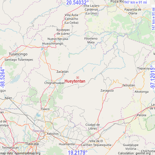
Hueytentan GPS coordinates[2]
19° 52' 49.764" North, 97° 49' 23.772" West
| Map corner | latitude | longitude |
|---|---|---|
| Upper-left | 20.54032°, | -98.5264° |
| Center: | 19.88049°, | -97.82327° |
| Lower-right: | 19.2179°, | -97.12015° |
| Map W x H: | 147×147 km | = 91.3×91.3mi |
| max Lat: | 32.7° ⇑45.3% North |
| Hueytentan: | 19.88049° |
| min Lat: | ⇓54.7% South 14.53588° |
| min Long | Hueytentan | max Long |
| -117.105° | -97.82327° | -86.73105° |
| W 65.8%⇐ | ⇒34.2% E |
Elevation
Elevation of Hueytentan is 1615 m = 5299 ft, and this is 361.3 m = 1185 ft above average elevation for this country.
| Max E: |
3497 m = 11473 ft | 44.1% |
| Hueytentan | 1615 m 5299 ft | |
| Avg. | 1253.7 m = 4113 ft | |
Min E: |
-1 m = -3 ft | 55.9% |
See also: Mexico elevation on elevation.city.
Geographical zone
Hueytentan is located in North Torrid zone (between Equator and Tropic of Cancer). Distance of this Northern Tropic circle is 395.4 km =245.7 mi to North.| Distance of | km | miles | from Hueytentan |
|---|---|---|---|
| North Pole | 7796.6 | 4844.6 | to North |
| Arctic Circle | 5190.7 | 3225.4 | to North |
| Tropic Cancer | 395.4 | 245.7 | to North |
| Equator | 2210.5 | 1373.5 | to South |


Nearby cities:
15 places around Hueytentan: (largest is in red/bold)
• Ahuatlán
4.3 km =2.7 mi,  18°
18°
• Benito Juárez
7.9 km =4.9 mi,  154°
154°
• Cerro Verde (Ejecatepeco)
5.9 km =3.7 mi,  31°
31°
• Chicometepec (San Simón)
9.1 km =5.7 mi,  356°
356°
• Cuapancingo
6.9 km =4.3 mi,  206°
206°
• Cuautempan
4.7 km =2.9 mi,  38°
38°
• Ixtolco de Morelos
2.8 km =1.7 mi,  11°
11°
• Tetela de Ocampo
7.2 km =4.5 mi,  166°
166°
• Tlamanca de Hernández
8.4 km =5.2 mi, 5°
• Tlapacholoya
7.7 km =4.8 mi, 28°
• Totomoxtla
6.2 km =3.9 mi, 13°
• Vista Hermosa
5.4 km =3.4 mi,  52°
52°
• Xaltatempa de Lucas
2.4 km =1.5 mi,  264°
264°
• Xochitlaxco (San Baltazar)
8 km =5 mi,  328°
328°
• Zoyatitla
6.4 km =4 mi,  175°
175°
Sources, notices
• [Note1] Compared only with cities in Mexico existing in our database
• [Src1] Map data: © OpenStreetMap contributors (CC-BY-SA)
• [Src2] Other city data from geonames.org with taken over terms of usage.
• [Src3] Geographical zone / Annual Mean Temperature by Robert A. Rohde @ Wikipedia
