Tlapacholoya geodata
Tlapacholoya (Puebla) is a populated place; located in Mexico in America/Mexico_City (GMT-6) time zone. With population of 537 people, there are 15796 cities with bigger population in this country. Compared to other cities in Mexico, 55.8% of cities are located further ↓South; 66.2% of cities are located further ←West and 50.6% of cities have lower elevation than Tlapacholoya. Note1


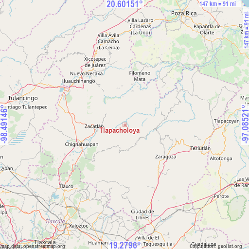
Tlapacholoya GPS coordinates[2]
19° 56' 30.984" North, 97° 47' 17.988" West
| Map corner | latitude | longitude |
|---|---|---|
| Upper-left | 20.60151°, | -98.49146° |
| Center: | 19.94194°, | -97.78833° |
| Lower-right: | 19.2796°, | -97.08521° |
| Map W x H: | 147×147 km | = 91.3×91.3mi |
| max Lat: | 32.7° ⇑44.2% North |
| Tlapacholoya: | 19.94194° |
| min Lat: | ⇓55.8% South 14.53588° |
| min Long | Tlapacholoya | max Long |
| -117.105° | -97.78833° | -86.73105° |
| W 66.2%⇐ | ⇒33.8% E |
Elevation
Elevation of Tlapacholoya is 1465 m = 4806 ft, and this is 211.3 m = 693 ft above average elevation for this country.
| Max E: |
3497 m = 11473 ft | 49.4% |
| Tlapacholoya | 1465 m 4806 ft | |
| Avg. | 1253.7 m = 4113 ft | |
Min E: |
-1 m = -3 ft | 50.6% |
See also: Mexico elevation on elevation.city.
Geographical zone
Tlapacholoya is located in North Torrid zone (between Equator and Tropic of Cancer). Distance of this Northern Tropic circle is 388.6 km =241.5 mi to North.| Distance of | km | miles | from Tlapacholoya |
|---|---|---|---|
| North Pole | 7789.7 | 4840.3 | to North |
| Arctic Circle | 5183.8 | 3221.1 | to North |
| Tropic Cancer | 388.6 | 241.5 | to North |
| Equator | 2217.3 | 1377.8 | to South |


Nearby cities:
15 places around Tlapacholoya: (largest is in red/bold)
• Ahuatlán
3.6 km =2.2 mi,  220°
220°
• Cerro Verde (Ejecatepeco)
1.9 km =1.2 mi,  198°
198°
• Chicometepec (San Simón)
4.8 km =3 mi,  298°
298°
• Cuautempan
3.2 km =2 mi,  192°
192°
• Hueytentan
7.7 km =4.8 mi,  208°
208°
• Ixtolco de Morelos
5.1 km =3.2 mi, 217°
• San Antonio Taltzintán
7 km =4.3 mi,  122°
122°
• Tenepanigia (Santa Elena)
3.2 km =2 mi,  33°
33°
• Tepango
6.9 km =4.3 mi,  352°
352°
• Tepetzintla
6.2 km =3.9 mi, 296°
• Tlamanca de Hernández
3.2 km =2 mi, 299°
• Tonalixco
6.9 km =4.3 mi,  309°
309°
• Totomoxtla
2.4 km =1.5 mi,  250°
250°
• Vista Hermosa
3.6 km =2.2 mi,  170°
170°
• Zongozotla
7.6 km =4.7 mi,  56°
56°
Sources, notices
• [Note1] Compared only with cities in Mexico existing in our database
• [Src1] Map data: © OpenStreetMap contributors (CC-BY-SA)
• [Src2] Other city data from geonames.org with taken over terms of usage.
• [Src3] Geographical zone / Annual Mean Temperature by Robert A. Rohde @ Wikipedia
