Totomoxtla geodata
Totomoxtla (Puebla) is a populated place; located in Mexico in America/Mexico_City (GMT-6) time zone. With population of 682 people, there are 12741 cities with bigger population in this country. Compared to other cities in Mexico, 55.7% of cities are located further ↓South; 66% of cities are located further ←West and 53.4% of cities have higher elevation than Totomoxtla. Note1


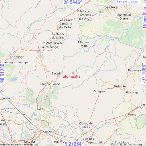
Totomoxtla GPS coordinates[2]
19° 56' 6" North, 97° 48' 34.992" West
| Map corner | latitude | longitude |
|---|---|---|
| Upper-left | 20.5946°, | -98.51285° |
| Center: | 19.935°, | -97.80972° |
| Lower-right: | 19.27264°, | -97.1066° |
| Map W x H: | 147×147 km | = 91.3×91.3mi |
| max Lat: | 32.7° ⇑44.3% North |
| Totomoxtla: | 19.935° |
| min Lat: | ⇓55.7% South 14.53588° |
| min Long | Totomoxtla | max Long |
| -117.105° | -97.80972° | -86.73105° |
| W 66%⇐ | ⇒34% E |
Elevation
Elevation of Totomoxtla is 1272 m = 4173 ft, and this is 18.3 m = 60 ft above average elevation for this country.
| Max E: |
3497 m = 11473 ft | 53.4% |
| Totomoxtla | 1272 m 4173 ft | |
| Avg. | 1253.7 m = 4113 ft | |
Min E: |
-1 m = -3 ft | 46.6% |
See also: Mexico elevation on elevation.city.
Geographical zone
Totomoxtla is located in North Torrid zone (between Equator and Tropic of Cancer). Distance of this Northern Tropic circle is 389.4 km =242 mi to North.| Distance of | km | miles | from Totomoxtla |
|---|---|---|---|
| North Pole | 7790.5 | 4840.8 | to North |
| Arctic Circle | 5184.6 | 3221.6 | to North |
| Tropic Cancer | 389.4 | 242 | to North |
| Equator | 2216.6 | 1377.3 | to South |


Nearby cities:
15 places around Totomoxtla: (largest is in red/bold)
• Ahuatlán
1.9 km =1.2 mi,  181°
181°
• Cerro Verde (Ejecatepeco)
1.9 km =1.2 mi,  122°
122°
• Chicometepec (San Simón)
3.6 km =2.2 mi,  327°
327°
• Cuautempan
2.8 km =1.7 mi,  146°
146°
• Hueytentan
6.2 km =3.9 mi,  193°
193°
• Ixtolco de Morelos
3.4 km =2.1 mi, 194°
• Tenepanigia (Santa Elena)
5.3 km =3.3 mi,  49°
49°
• Tepango
7.7 km =4.8 mi,  10°
10°
• Tepetzintla
4.9 km =3 mi,  317°
317°
• Tlamanca de Hernández
2.4 km =1.5 mi,  346°
346°
• Tlapacholoya
2.4 km =1.5 mi,  70°
70°
• Tonalixco
6 km =3.7 mi, 328°
• Vista Hermosa
3.9 km =2.4 mi,  134°
134°
• Xaltatempa de Lucas
7.4 km =4.6 mi,  211°
211°
• Xochitlaxco (San Baltazar)
5.7 km =3.5 mi,  277°
277°
Sources, notices
• [Note1] Compared only with cities in Mexico existing in our database
• [Src1] Map data: © OpenStreetMap contributors (CC-BY-SA)
• [Src2] Other city data from geonames.org with taken over terms of usage.
• [Src3] Geographical zone / Annual Mean Temperature by Robert A. Rohde @ Wikipedia
