El Pintor geodata
El Pintor (Hidalgo) is a populated place; located in Mexico in America/Mexico_City (GMT-6) time zone. With population of 1,474 people, there are 5858 cities with bigger population in this country. Compared to other cities in Mexico, 78.7% of cities are located further ↓South; 58.4% of cities are located further ←West and 77.3% of cities have higher elevation than El Pintor. Note1


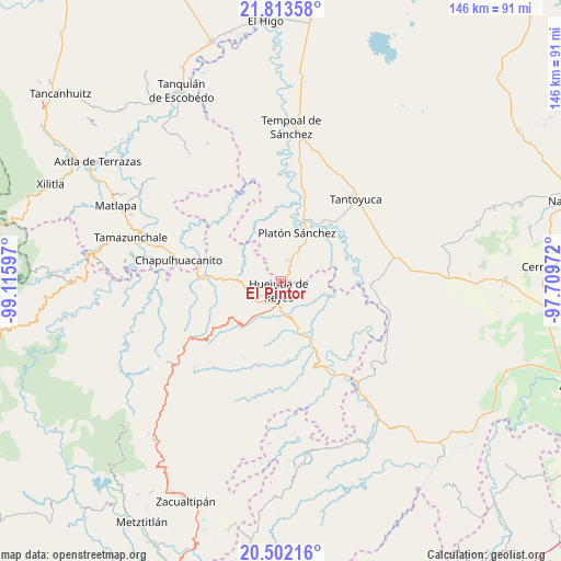
El Pintor GPS coordinates[2]
21° 9' 33.552" North, 98° 24' 46.224" West
| Map corner | latitude | longitude |
|---|---|---|
| Upper-left | 21.81358°, | -99.11597° |
| Center: | 21.15932°, | -98.41284° |
| Lower-right: | 20.50216°, | -97.70972° |
| Map W x H: | 145.8×145.8 km | = 90.6×90.6mi |
| max Lat: | 32.7° ⇑21.3% North |
| El Pintor: | 21.15932° |
| min Lat: | ⇓78.7% South 14.53588° |
| min Long | El Pintor | max Long |
| -117.105° | -98.41284° | -86.73105° |
| W 58.4%⇐ | ⇒41.6% E |
Elevation
Elevation of El Pintor is 145 m = 476 ft, and this is 1108.7 m = 3637 ft below average elevation for this country.
| Max E: |
3497 m = 11473 ft | 77.3% |
| Avg. | 1253.7 m = 4113 ft | |
| El Pintor | 145 m = 476 ft | |
Min E: |
-1 m = -3 ft | 22.7% |
See also: Mexico elevation on elevation.city.
Geographical zone
El Pintor is located in North Torrid zone (between Equator and Tropic of Cancer). Distance of this Northern Tropic circle is 253.2 km =157.3 mi to North.| Distance of | km | miles | from El Pintor |
|---|---|---|---|
| North Pole | 7654.4 | 4756.2 | to North |
| Arctic Circle | 5048.5 | 3137 | to North |
| Tropic Cancer | 253.2 | 157.3 | to North |
| Equator | 2352.7 | 1461.9 | to South |


Nearby cities:
15 places around El Pintor: (largest is in red/bold)
• Aguacatitla
6.3 km =3.9 mi,  215°
215°
• Chalahuiyapa
5.1 km =3.2 mi,  100°
100°
• Chalma
5.7 km =3.5 mi,  15°
15°
• Chililico
3.6 km =2.2 mi, 220°
• Corral Blanco (Todos por Hidalgo)
2.6 km =1.6 mi, 104°
• Huejutla de Reyes
2.3 km =1.4 mi,  197°
197°
• Hueynali
4.7 km =2.9 mi,  254°
254°
• La Curva Tlaltzintla
5.3 km =3.3 mi,  230°
230°
• Las Pilas
0.9 km =0.6 mi, 97°
• Motoltepec
4.9 km =3 mi,  79°
79°
• Panacaxtlán
4.5 km =2.8 mi,  255°
255°
• Parque de Poblamiento Solidaridad
2.9 km =1.8 mi,  106°
106°
• Tancazahuela
3.5 km =2.2 mi,  319°
319°
• Tepexititla
4.7 km =2.9 mi, 229°
• Zapotitla
4.6 km =2.9 mi, 227°
Sources, notices
• [Note1] Compared only with cities in Mexico existing in our database
• [Src1] Map data: © OpenStreetMap contributors (CC-BY-SA)
• [Src2] Other city data from geonames.org with taken over terms of usage.
• [Src3] Geographical zone / Annual Mean Temperature by Robert A. Rohde @ Wikipedia
