Tancazahuela geodata
Tancazahuela (Hidalgo) is a populated place; located in Mexico in America/Mexico_City (GMT-6) time zone. With population of 1,315 people, there are 6597 cities with bigger population in this country. Compared to other cities in Mexico, 78.9% of cities are located further ↓South; 58.2% of cities are located further ←West and 76.1% of cities have higher elevation than Tancazahuela. Note1


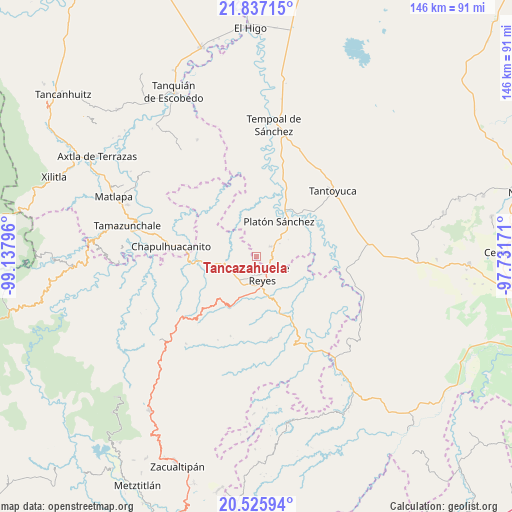
Tancazahuela GPS coordinates[2]
21° 10' 58.8" North, 98° 26' 5.388" West
| Map corner | latitude | longitude |
|---|---|---|
| Upper-left | 21.83715°, | -99.13796° |
| Center: | 21.183°, | -98.43483° |
| Lower-right: | 20.52594°, | -97.73171° |
| Map W x H: | 145.8×145.8 km | = 90.6×90.6mi |
| max Lat: | 32.7° ⇑21.1% North |
| Tancazahuela: | 21.183° |
| min Lat: | ⇓78.9% South 14.53588° |
| min Long | Tancazahuela | max Long |
| -117.105° | -98.43483° | -86.73105° |
| W 58.2%⇐ | ⇒41.8% E |
Elevation
Elevation of Tancazahuela is 182 m = 597 ft, and this is 1071.7 m = 3516 ft below average elevation for this country.
| Max E: |
3497 m = 11473 ft | 76.1% |
| Avg. | 1253.7 m = 4113 ft | |
| Tancazahuela | 182 m = 597 ft | |
Min E: |
-1 m = -3 ft | 23.9% |
See also: Mexico elevation on elevation.city.
Geographical zone
Tancazahuela is located in North Torrid zone (between Equator and Tropic of Cancer). Distance of this Northern Tropic circle is 250.6 km =155.7 mi to North.| Distance of | km | miles | from Tancazahuela |
|---|---|---|---|
| North Pole | 7651.7 | 4754.5 | to North |
| Arctic Circle | 5045.8 | 3135.3 | to North |
| Tropic Cancer | 250.6 | 155.7 | to North |
| Equator | 2355.3 | 1463.5 | to South |


Nearby cities:
15 places around Tancazahuela: (largest is in red/bold)
• Chalma
4.8 km =3 mi,  53°
53°
• Chiconamel
5.9 km =3.7 mi,  333°
333°
• Chililico
5.4 km =3.4 mi,  180°
180°
• Corral Blanco (Todos por Hidalgo)
5.8 km =3.6 mi,  124°
124°
• El Pintor
3.5 km =2.2 mi,  139°
139°
• Huejutla de Reyes
5 km =3.1 mi,  161°
161°
• Hueynali
4.5 km =2.8 mi,  209°
209°
• Las Pilas
4.2 km =2.6 mi,  131°
131°
• Panacaxtlán
4.3 km =2.7 mi, 209°
• Parque de Poblamiento Solidaridad
6.1 km =3.8 mi, 124°
• San Pedro Coyutla
4.6 km =2.9 mi,  6°
6°
• Tepexititla
5.8 km =3.6 mi,  192°
192°
• Zapotitla
5.8 km =3.6 mi, 190°
• Zitlán
5.4 km =3.4 mi,  247°
247°
• Ámaxac
5.7 km =3.5 mi,  309°
309°
Sources, notices
• [Note1] Compared only with cities in Mexico existing in our database
• [Src1] Map data: © OpenStreetMap contributors (CC-BY-SA)
• [Src2] Other city data from geonames.org with taken over terms of usage.
• [Src3] Geographical zone / Annual Mean Temperature by Robert A. Rohde @ Wikipedia
