Chalahuiyapa geodata
Chalahuiyapa (Hidalgo) is a populated place; located in Mexico in America/Mexico_City (GMT-6) time zone. With population of 1,341 people, there are 6487 cities with bigger population in this country. Compared to other cities in Mexico, 78.6% of cities are located further ↓South; 59.1% of cities are located further ←West and 78.8% of cities have higher elevation than Chalahuiyapa. Note1


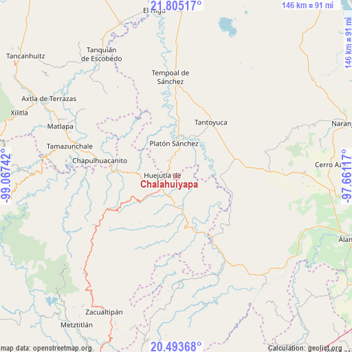
Chalahuiyapa GPS coordinates[2]
21° 9' 3.168" North, 98° 21' 51.444" West
| Map corner | latitude | longitude |
|---|---|---|
| Upper-left | 21.80517°, | -99.06742° |
| Center: | 21.15088°, | -98.36429° |
| Lower-right: | 20.49368°, | -97.66117° |
| Map W x H: | 145.8×145.8 km | = 90.6×90.6mi |
| max Lat: | 32.7° ⇑21.4% North |
| Chalahuiyapa: | 21.15088° |
| min Lat: | ⇓78.6% South 14.53588° |
| min Long | Chalahuiyapa | max Long |
| -117.105° | -98.36429° | -86.73105° |
| W 59.1%⇐ | ⇒40.9% E |
Elevation
Elevation of Chalahuiyapa is 115 m = 377 ft, and this is 1138.7 m = 3736 ft below average elevation for this country.
| Max E: |
3497 m = 11473 ft | 78.8% |
| Avg. | 1253.7 m = 4113 ft | |
| Chalahuiyapa | 115 m = 377 ft | |
Min E: |
-1 m = -3 ft | 21.2% |
See also: Mexico elevation on elevation.city.
Geographical zone
Chalahuiyapa is located in North Torrid zone (between Equator and Tropic of Cancer). Distance of this Northern Tropic circle is 254.2 km =158 mi to North.| Distance of | km | miles | from Chalahuiyapa |
|---|---|---|---|
| North Pole | 7655.3 | 4756.8 | to North |
| Arctic Circle | 5049.4 | 3137.6 | to North |
| Tropic Cancer | 254.2 | 158 | to North |
| Equator | 2351.8 | 1461.3 | to South |


Nearby cities:
15 places around Chalahuiyapa: (largest is in red/bold)
• Ahuatempa
6.1 km =3.8 mi,  198°
198°
• Chalma
7.3 km =4.5 mi,  331°
331°
• Chililico
7.6 km =4.7 mi,  256°
256°
• Congreso Permanente Agrario
7 km =4.3 mi,  104°
104°
• Corral Blanco (Todos por Hidalgo)
2.5 km =1.6 mi,  276°
276°
• El Pintor
5.1 km =3.2 mi, 280°
• Huejutla de Reyes
5.8 km =3.6 mi, 258°
• La Candelaria
8.5 km =5.3 mi,  209°
209°
• Las Pilas
4.2 km =2.6 mi, 281°
• Los Otates
1.9 km =1.2 mi,  90°
90°
• Motoltepec
1.8 km =1.1 mi,  352°
352°
• Parque de Poblamiento Solidaridad
2.3 km =1.4 mi,  272°
272°
• Rancho Viejo
5 km =3.1 mi,  74°
74°
• Santa Catarina
5.9 km =3.7 mi, 196°
• Tancazahuela
8.1 km =5 mi,  296°
296°
Sources, notices
• [Note1] Compared only with cities in Mexico existing in our database
• [Src1] Map data: © OpenStreetMap contributors (CC-BY-SA)
• [Src2] Other city data from geonames.org with taken over terms of usage.
• [Src3] Geographical zone / Annual Mean Temperature by Robert A. Rohde @ Wikipedia
