Santa María Apazco geodata
Santa María Apazco (Oaxaca) is a seat of a second-order administrative division; located in Mexico in America/Mexico_City (GMT-6) time zone. With population of 432 people, there are 16837 cities with bigger population in this country. Compared to other cities in Mexico, 81.9% of cities are located further ↑North; 73.6% of cities are located further ←West and 81.6% of cities have lower elevation than Santa María Apazco. Note1


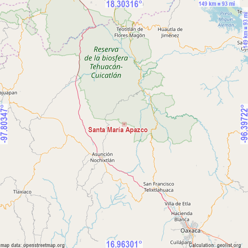
Santa María Apazco GPS coordinates[2]
17° 38' 3.588" North, 97° 6' 1.224" West
| Map corner | latitude | longitude |
|---|---|---|
| Upper-left | 18.30316°, | -97.80347° |
| Center: | 17.63433°, | -97.10034° |
| Lower-right: | 16.96301°, | -96.39722° |
| Map W x H: | 149×149 km | = 92.6×92.6mi |
| max Lat: | 32.7° ⇑81.9% North |
| Santa María Apazco: | 17.63433° |
| min Lat: | ⇓18.1% South 14.53588° |
| min Long | Santa María Ap | max Long |
| -117.105° | -97.10034° | -86.73105° |
| W 73.6%⇐ | ⇒26.4% E |
Elevation
Elevation of Santa María Apazco is 2178 m = 7146 ft, and this is 924.3 m = 3032 ft above average elevation for this country.
| Max E: |
3497 m = 11473 ft | 18.4% |
| Santa María Apazco | 2178 m 7146 ft | |
| Avg. | 1253.7 m = 4113 ft | |
Min E: |
-1 m = -3 ft | 81.6% |
See also: Mexico elevation on elevation.city.
Geographical zone
Santa María Apazco is located in North Torrid zone (between Equator and Tropic of Cancer). Distance of this Northern Tropic circle is 645.2 km =400.9 mi to North.| Distance of | km | miles | from Santa María Apazco |
|---|---|---|---|
| North Pole | 8046.3 | 4999.7 | to North |
| Arctic Circle | 5440.4 | 3380.5 | to North |
| Tropic Cancer | 645.2 | 400.9 | to North |
| Equator | 1960.8 | 1218.4 | to South |


Nearby cities:
15 places around Santa María Apazco: (largest is in red/bold)
• Apoala
4.1 km =2.5 mi,  292°
292°
• Chicahua
10 km =6.2 mi,  271°
271°
• El Fortín Alto
10.7 km =6.6 mi,  254°
254°
• Jaltepetongo
9 km =5.6 mi,  49°
49°
• San José del Chilar
19.3 km =12 mi,  63°
63°
• San Miguel Huautla
12.6 km =7.8 mi,  338°
338°
• San Miguel Huautla
12.9 km =8 mi, 342°
• San Pedro Chicozapotes
21.2 km =13.2 mi, 45°
• San Pedro Coxcaltepec Cántaros
15.5 km =9.6 mi,  194°
194°
• San Pedro Jocotipac
15.1 km =9.4 mi,  8°
8°
• Santiago Huauclilla
20.5 km =12.7 mi,  171°
171°
• Soyaltepec
22.5 km =14 mi,  257°
257°
• Texcatitlán
9.4 km =5.8 mi,  22°
22°
• Tomellín
20.3 km =12.6 mi, 46°
• Valerio Trujano
20 km =12.4 mi,  39°
39°
Sources, notices
• [Note1] Compared only with cities in Mexico existing in our database
• [Src1] Map data: © OpenStreetMap contributors (CC-BY-SA)
• [Src2] Other city data from geonames.org with taken over terms of usage.
• [Src3] Geographical zone / Annual Mean Temperature by Robert A. Rohde @ Wikipedia
