Buenavista geodata
Buenavista (State of Mexico) is a populated place; located in Mexico in America/Mexico_City (GMT-6) time zone. With population of 544 people, there are 15626 cities with bigger population in this country. Compared to other cities in Mexico, 57.2% of cities are located further ↓South; 61.4% of cities are located further →East and 97.4% of cities have lower elevation than Buenavista. Note1


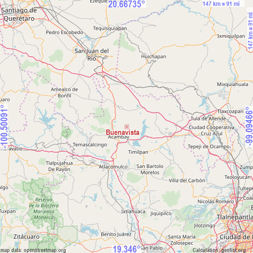
Buenavista GPS coordinates[2]
20° 0' 29.016" North, 99° 47' 52.008" West
| Map corner | latitude | longitude |
|---|---|---|
| Upper-left | 20.66735°, | -100.50091° |
| Center: | 20.00806°, | -99.79778° |
| Lower-right: | 19.346°, | -99.09466° |
| Map W x H: | 146.9×146.9 km | = 91.3×91.3mi |
| max Lat: | 32.7° ⇑42.8% North |
| Buenavista: | 20.00806° |
| min Lat: | ⇓57.2% South 14.53588° |
| min Long | Buenavista | max Long |
| -117.105° | -99.79778° | -86.73105° |
| W 38.6%⇐ | ⇒61.4% E |
Elevation
Elevation of Buenavista is 2705 m = 8875 ft, and this is 1451.3 m = 4761 ft above average elevation for this country.
| Max E: |
3497 m = 11473 ft | 2.6% |
| Buenavista | 2705 m 8875 ft | |
| Avg. | 1253.7 m = 4113 ft | |
Min E: |
-1 m = -3 ft | 97.4% |
See also: Mexico elevation on elevation.city.
Geographical zone
Buenavista is located in North Torrid zone (between Equator and Tropic of Cancer). Distance of this Northern Tropic circle is 381.2 km =236.9 mi to North.| Distance of | km | miles | from Buenavista |
|---|---|---|---|
| North Pole | 7782.4 | 4835.8 | to North |
| Arctic Circle | 5176.5 | 3216.5 | to North |
| Tropic Cancer | 381.2 | 236.9 | to North |
| Equator | 2224.7 | 1382.4 | to South |


Nearby cities:
15 places around Buenavista: (largest is in red/bold)
• Acambay
7.6 km =4.7 mi,  219°
219°
• Botidi
6.6 km =4.1 mi,  225°
225°
• El Bonxhi
9.6 km =6 mi,  38°
38°
• Endeje
6.6 km =4.1 mi, 217°
• Fondo
6.6 km =4.1 mi,  30°
30°
• Ganzda
5.6 km =3.5 mi,  248°
248°
• La Caridad
7.9 km =4.9 mi,  211°
211°
• Las Arenas (San Agustín)
7.4 km =4.6 mi,  105°
105°
• Loma Linda
2.5 km =1.6 mi,  279°
279°
• Los Pilares
8.2 km =5.1 mi,  91°
91°
• San Ildefonso (San Ildefonso Yolotepec)
8.9 km =5.5 mi, 207°
• San Juanico Sector Dos
7.9 km =4.9 mi,  170°
170°
• San Juanico Sector Uno
8.8 km =5.5 mi,  159°
159°
• Santa María Nativitas
9.3 km =5.8 mi,  359°
359°
• Ñado Buenavista
8.6 km =5.3 mi,  311°
311°
Sources, notices
• [Note1] Compared only with cities in Mexico existing in our database
• [Src1] Map data: © OpenStreetMap contributors (CC-BY-SA)
• [Src2] Other city data from geonames.org with taken over terms of usage.
• [Src3] Geographical zone / Annual Mean Temperature by Robert A. Rohde @ Wikipedia
