San Carlos geodata
San Carlos (Tabasco) is a populated place; located in Mexico in America/Mexico_City (GMT-6) time zone. With population of 13,054 people, there are 751 cities with bigger population in this country. Compared to other cities in Mexico, 82.6% of cities are located further ↑North; 96.7% of cities are located further ←West and 83.5% of cities have higher elevation than San Carlos. Note1


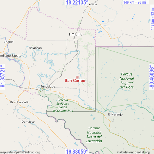
San Carlos GPS coordinates[2]
17° 33' 7.956" North, 91° 9' 14.688" West
| Map corner | latitude | longitude |
|---|---|---|
| Upper-left | 18.22135°, | -91.85721° |
| Center: | 17.55221°, | -91.15408° |
| Lower-right: | 16.88059°, | -90.45096° |
| Map W x H: | 149.1×149.1 km | = 92.6×92.6mi |
| max Lat: | 32.7° ⇑82.6% North |
| San Carlos: | 17.55221° |
| min Lat: | ⇓17.4% South 14.53588° |
| min Long | San Carlos | max Long |
| -117.105° | -91.15408° | -86.73105° |
| W 96.7%⇐ | ⇒3.3% E |
Elevation
Elevation of San Carlos is 56 m = 184 ft, and this is 1197.7 m = 3929 ft below average elevation for this country.
| Max E: |
3497 m = 11473 ft | 83.5% |
| Avg. | 1253.7 m = 4113 ft | |
| San Carlos | 56 m = 184 ft | |
Min E: |
-1 m = -3 ft | 16.5% |
See also: Mexico elevation on elevation.city.
Geographical zone
San Carlos is located in North Torrid zone (between Equator and Tropic of Cancer). Distance of this Northern Tropic circle is 654.3 km =406.6 mi to North.| Distance of | km | miles | from San Carlos |
|---|---|---|---|
| North Pole | 8055.4 | 5005.4 | to North |
| Arctic Circle | 5449.6 | 3386.2 | to North |
| Tropic Cancer | 654.3 | 406.6 | to North |
| Equator | 1951.6 | 1212.7 | to South |


Nearby cities:
15 places around San Carlos: (largest is in red/bold)
• Apatzingán
11.1 km =6.9 mi,  56°
56°
• Capitán Felipe Castellanos Díaz (San Pedro)
24.6 km =15.3 mi,  1°
1°
• Certeza
25 km =15.5 mi,  245°
245°
• El Capulín
18.6 km =11.6 mi,  22°
22°
• El Chamizal
12.1 km =7.5 mi,  120°
120°
• El Palmar
16.9 km =10.5 mi,  132°
132°
• El Águila
16.3 km =10.1 mi,  314°
314°
• Estapilla
26.6 km =16.5 mi,  268°
268°
• Ignacio Allende
28.6 km =17.8 mi,  193°
193°
• Jolochero
8.7 km =5.4 mi,  110°
110°
• Los Cenotes
15.4 km =9.6 mi,  53°
53°
• Mactún
15.3 km =9.5 mi,  285°
285°
• Multé
28.3 km =17.6 mi,  302°
302°
• Paraíso (El Tinto)
4 km =2.5 mi, 16°
• Santa Cruz
20.2 km =12.6 mi,  137°
137°
Sources, notices
• [Note1] Compared only with cities in Mexico existing in our database
• [Src1] Map data: © OpenStreetMap contributors (CC-BY-SA)
• [Src2] Other city data from geonames.org with taken over terms of usage.
• [Src3] Geographical zone / Annual Mean Temperature by Robert A. Rohde @ Wikipedia
