Jolochero geodata
Jolochero (Tabasco) is a populated place; located in Mexico in America/Mexico_City (GMT-6) time zone. With population of 737 people, there are 11858 cities with bigger population in this country. Compared to other cities in Mexico, 82.9% of cities are located further ↑North; 96.7% of cities are located further ←West and 83% of cities have higher elevation than Jolochero. Note1


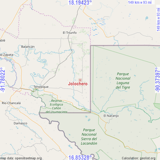
Jolochero GPS coordinates[2]
17° 31' 29.964" North, 91° 4' 37.524" West
| Map corner | latitude | longitude |
|---|---|---|
| Upper-left | 18.19423°, | -91.78022° |
| Center: | 17.52499°, | -91.07709° |
| Lower-right: | 16.85328°, | -90.37397° |
| Map W x H: | 149.1×149.1 km | = 92.6×92.6mi |
| max Lat: | 32.7° ⇑82.9% North |
| Jolochero: | 17.52499° |
| min Lat: | ⇓17.1% South 14.53588° |
| min Long | Jolochero | max Long |
| -117.105° | -91.07709° | -86.73105° |
| W 96.7%⇐ | ⇒3.3% E |
Elevation
Elevation of Jolochero is 60 m = 197 ft, and this is 1193.7 m = 3916 ft below average elevation for this country.
| Max E: |
3497 m = 11473 ft | 83% |
| Avg. | 1253.7 m = 4113 ft | |
| Jolochero | 60 m = 197 ft | |
Min E: |
-1 m = -3 ft | 17% |
See also: Mexico elevation on elevation.city.
Geographical zone
Jolochero is located in North Torrid zone (between Equator and Tropic of Cancer). Distance of this Northern Tropic circle is 657.3 km =408.4 mi to North.| Distance of | km | miles | from Jolochero |
|---|---|---|---|
| North Pole | 8058.5 | 5007.3 | to North |
| Arctic Circle | 5452.6 | 3388.1 | to North |
| Tropic Cancer | 657.3 | 408.4 | to North |
| Equator | 1948.6 | 1210.8 | to South |


Nearby cities:
15 places around Jolochero: (largest is in red/bold)
• Apatzingán
9.3 km =5.8 mi,  6°
6°
• Capitán Felipe Castellanos Díaz (San Pedro)
28.6 km =17.8 mi,  344°
344°
• Certeza
31.8 km =19.8 mi,  256°
256°
• El Capulín
20.2 km =12.6 mi,  356°
356°
• El Chamizal
3.8 km =2.4 mi,  144°
144°
• El Palmar
9.4 km =5.8 mi,  153°
153°
• El Águila
24.6 km =15.3 mi,  306°
306°
• Ignacio Allende
28.9 km =18 mi,  211°
211°
• Los Cenotes
12.9 km =8 mi,  18°
18°
• Mactún
24 km =14.9 mi,  287°
287°
• Paraíso (El Tinto)
9.8 km =6.1 mi, 314°
• Redención del Campesino
31.1 km =19.3 mi,  225°
225°
• San Carlos
8.7 km =5.4 mi, 290°
• Santa Cruz
13.1 km =8.1 mi,  155°
155°
• Álvaro Obregón
30.8 km =19.1 mi, 211°
Sources, notices
• [Note1] Compared only with cities in Mexico existing in our database
• [Src1] Map data: © OpenStreetMap contributors (CC-BY-SA)
• [Src2] Other city data from geonames.org with taken over terms of usage.
• [Src3] Geographical zone / Annual Mean Temperature by Robert A. Rohde @ Wikipedia
