El Palmar geodata
El Palmar (Tabasco) is a populated place; located in Mexico in America/Mexico_City (GMT-6) time zone. With population of 681 people, there are 12756 cities with bigger population in this country. Compared to other cities in Mexico, 83.6% of cities are located further ↑North; 96.8% of cities are located further ←West and 83.4% of cities have higher elevation than El Palmar. Note1


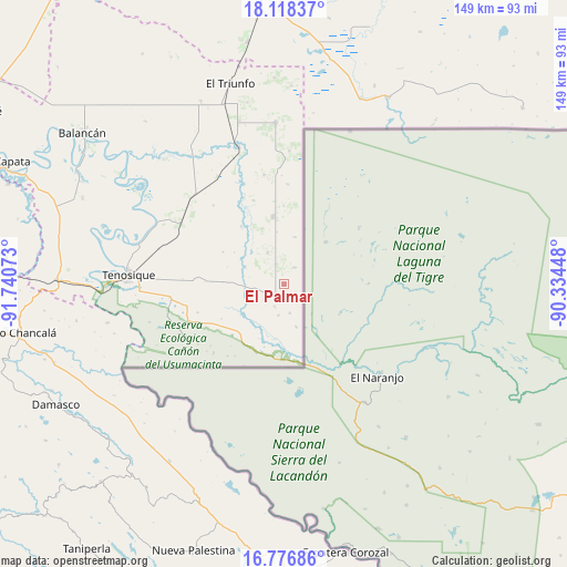
El Palmar GPS coordinates[2]
17° 26' 55.86" North, 91° 2' 15.36" West
| Map corner | latitude | longitude |
|---|---|---|
| Upper-left | 18.11837°, | -91.74073° |
| Center: | 17.44885°, | -91.0376° |
| Lower-right: | 16.77686°, | -90.33448° |
| Map W x H: | 149.2×149.2 km | = 92.7×92.7mi |
| max Lat: | 32.7° ⇑83.6% North |
| El Palmar: | 17.44885° |
| min Lat: | ⇓16.4% South 14.53588° |
| min Long | El Palmar | max Long |
| -117.105° | -91.0376° | -86.73105° |
| W 96.8%⇐ | ⇒3.2% E |
Elevation
Elevation of El Palmar is 57 m = 187 ft, and this is 1196.7 m = 3926 ft below average elevation for this country.
| Max E: |
3497 m = 11473 ft | 83.4% |
| Avg. | 1253.7 m = 4113 ft | |
| El Palmar | 57 m = 187 ft | |
Min E: |
-1 m = -3 ft | 16.6% |
See also: Mexico elevation on elevation.city.
Geographical zone
El Palmar is located in North Torrid zone (between Equator and Tropic of Cancer). Distance of this Northern Tropic circle is 665.8 km =413.7 mi to North.| Distance of | km | miles | from El Palmar |
|---|---|---|---|
| North Pole | 8066.9 | 5012.5 | to North |
| Arctic Circle | 5461 | 3393.3 | to North |
| Tropic Cancer | 665.8 | 413.7 | to North |
| Equator | 1940.1 | 1205.5 | to South |


Nearby cities:
15 places around El Palmar: (largest is in red/bold)
• Apatzingán
18 km =11.2 mi,  350°
350°
• Capitán Felipe Castellanos Díaz (San Pedro)
37.9 km =23.5 mi,  342°
342°
• Certeza
35.2 km =21.9 mi,  272°
272°
• El Capulín
29.2 km =18.1 mi, 349°
• El Chamizal
5.7 km =3.5 mi, 339°
• El Águila
33.2 km =20.6 mi,  313°
313°
• Ignacio Allende
25.2 km =15.7 mi,  229°
229°
• Jolochero
9.4 km =5.8 mi,  333°
333°
• Los Cenotes
20.7 km =12.9 mi,  0°
0°
• Mactún
31.3 km =19.4 mi,  300°
300°
• Paraíso (El Tinto)
19 km =11.8 mi,  323°
323°
• Redención del Campesino
29.5 km =18.3 mi,  242°
242°
• San Carlos
16.9 km =10.5 mi, 312°
• Santa Cruz
3.7 km =2.3 mi,  159°
159°
• Álvaro Obregón
27 km =16.8 mi, 228°
Sources, notices
• [Note1] Compared only with cities in Mexico existing in our database
• [Src1] Map data: © OpenStreetMap contributors (CC-BY-SA)
• [Src2] Other city data from geonames.org with taken over terms of usage.
• [Src3] Geographical zone / Annual Mean Temperature by Robert A. Rohde @ Wikipedia
