El Arenal geodata
El Arenal (Chiapas) is a populated place; located in Mexico in America/Mexico_City (GMT-6) time zone. With population of 860 people, there are 10174 cities with bigger population in this country. Compared to other cities in Mexico, 99.3% of cities are located further ↑North; 92% of cities are located further ←West and 89% of cities have higher elevation than El Arenal. Note1


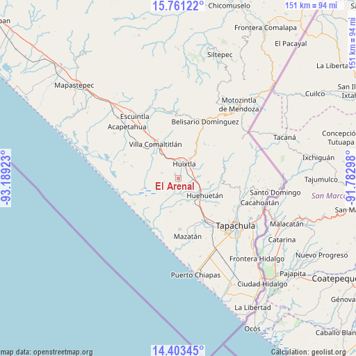
El Arenal GPS coordinates[2]
15° 5' 0.312" North, 92° 29' 9.96" West
| Map corner | latitude | longitude |
|---|---|---|
| Upper-left | 15.76122°, | -93.18923° |
| Center: | 15.08342°, | -92.4861° |
| Lower-right: | 14.40345°, | -91.78298° |
| Map W x H: | 151×151 km | = 93.8×93.8mi |
| max Lat: | 32.7° ⇑99.3% North |
| El Arenal: | 15.08342° |
| min Lat: | ⇓0.7% South 14.53588° |
| min Long | El Arenal | max Long |
| -117.105° | -92.4861° | -86.73105° |
| W 92%⇐ | ⇒8% E |
Elevation
Elevation of El Arenal is 27 m = 89 ft, and this is 1226.7 m = 4025 ft below average elevation for this country.
| Max E: |
3497 m = 11473 ft | 89% |
| Avg. | 1253.7 m = 4113 ft | |
| El Arenal | 27 m = 89 ft | |
Min E: |
-1 m = -3 ft | 11% |
See also: Mexico elevation on elevation.city.
Geographical zone
El Arenal is located in North Torrid zone (between Equator and Tropic of Cancer). Distance of this Northern Tropic circle is 928.8 km =577.1 mi to North.| Distance of | km | miles | from El Arenal |
|---|---|---|---|
| North Pole | 8329.9 | 5176 | to North |
| Arctic Circle | 5724.1 | 3556.8 | to North |
| Tropic Cancer | 928.8 | 577.1 | to North |
| Equator | 1677.1 | 1042.1 | to South |


Nearby cities:
15 places around El Arenal: (largest is in red/bold)
• Cantón Playa Grande
4.9 km =3 mi,  316°
316°
• Cantón Rancho Nuevo
4.6 km =2.9 mi,  247°
247°
• Cantón las Delicias
2.6 km =1.6 mi, 324°
• Colonia Obrera
2.1 km =1.3 mi, 321°
• Cuarto Cantón
4.8 km =3 mi,  80°
80°
• Efraín A. Gutiérrez
7.6 km =4.7 mi,  288°
288°
• El Chipilín
7.6 km =4.7 mi,  56°
56°
• Estación Tuzantán
4.6 km =2.9 mi, 55°
• Francisco I. Madero
6.4 km =4 mi,  256°
256°
• Huixtla
6.6 km =4.1 mi,  20°
20°
• La Unión
4.1 km =2.5 mi,  220°
220°
• Nueva Victoria
7.2 km =4.5 mi,  169°
169°
• Primer Cantón
6.4 km =4 mi,  50°
50°
• Segundo Cantón
5.8 km =3.6 mi,  70°
70°
• Xochiltepec
7.5 km =4.7 mi, 48°
Sources, notices
• [Note1] Compared only with cities in Mexico existing in our database
• [Src1] Map data: © OpenStreetMap contributors (CC-BY-SA)
• [Src2] Other city data from geonames.org with taken over terms of usage.
• [Src3] Geographical zone / Annual Mean Temperature by Robert A. Rohde @ Wikipedia
