Coaxtlahuacán geodata
Coaxtlahuacán (Guerrero) is a populated place; located in Mexico in America/Mexico_City (GMT-6) time zone. With population of 664 people, there are 13077 cities with bigger population in this country. Compared to other cities in Mexico, 84.3% of cities are located further ↑North; 54.9% of cities are located further →East and 58.6% of cities have lower elevation than Coaxtlahuacán. Note1


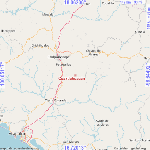
Coaxtlahuacán GPS coordinates[2]
17° 23' 32.388" North, 99° 20' 52.944" West
| Map corner | latitude | longitude |
|---|---|---|
| Upper-left | 18.06206°, | -100.05117° |
| Center: | 17.39233°, | -99.34804° |
| Lower-right: | 16.72013°, | -98.64492° |
| Map W x H: | 149.2×149.2 km | = 92.7×92.7mi |
| max Lat: | 32.7° ⇑84.3% North |
| Coaxtlahuacán: | 17.39233° |
| min Lat: | ⇓15.7% South 14.53588° |
| min Long | Coaxtlahuacán | max Long |
| -117.105° | -99.34804° | -86.73105° |
| W 45.1%⇐ | ⇒54.9% E |
Elevation
Elevation of Coaxtlahuacán is 1701 m = 5581 ft, and this is 447.3 m = 1468 ft above average elevation for this country.
| Max E: |
3497 m = 11473 ft | 41.4% |
| Coaxtlahuacán | 1701 m 5581 ft | |
| Avg. | 1253.7 m = 4113 ft | |
Min E: |
-1 m = -3 ft | 58.6% |
See also: Mexico elevation on elevation.city.
Geographical zone
Coaxtlahuacán is located in North Torrid zone (between Equator and Tropic of Cancer). Distance of this Northern Tropic circle is 672.1 km =417.6 mi to North.| Distance of | km | miles | from Coaxtlahuacán |
|---|---|---|---|
| North Pole | 8073.2 | 5016.5 | to North |
| Arctic Circle | 5467.3 | 3397.2 | to North |
| Tropic Cancer | 672.1 | 417.6 | to North |
| Equator | 1933.8 | 1201.6 | to South |


Nearby cities:
15 places around Coaxtlahuacán: (largest is in red/bold)
• Acahuizotla
13.2 km =8.2 mi,  254°
254°
• Aztatepec
7.4 km =4.6 mi,  105°
105°
• Coatomatitlán
9.2 km =5.7 mi,  15°
15°
• Coscamila
13.9 km =8.6 mi,  78°
78°
• Mazatlán
13.3 km =8.3 mi,  291°
291°
• Mochitlán
9.2 km =5.7 mi,  344°
344°
• Monte Alegre
12.9 km =8 mi,  25°
25°
• Ostocapa
14.5 km =9 mi,  65°
65°
• Palo Blanco
12.6 km =7.8 mi,  275°
275°
• Quechultenango
11.5 km =7.1 mi, 77°
• San Martín
9.7 km =6 mi,  35°
35°
• San Miguel
9.3 km =5.8 mi, 31°
• Santa Cruz
12.8 km =8 mi,  135°
135°
• Tepechicotlán
12.4 km =7.7 mi,  324°
324°
• Zacatzonapa
12.2 km =7.6 mi,  2°
2°
Sources, notices
• [Note1] Compared only with cities in Mexico existing in our database
• [Src1] Map data: © OpenStreetMap contributors (CC-BY-SA)
• [Src2] Other city data from geonames.org with taken over terms of usage.
• [Src3] Geographical zone / Annual Mean Temperature by Robert A. Rohde @ Wikipedia
