Corozal geodata
Corozal (Veracruz) is a populated place; located in Mexico in America/Mexico_City (GMT-6) time zone. With population of 1,927 people, there are 4515 cities with bigger population in this country. Compared to other cities in Mexico, 81.7% of cities are located further ↓South; 56.6% of cities are located further ←West and 78% of cities have higher elevation than Corozal. Note1


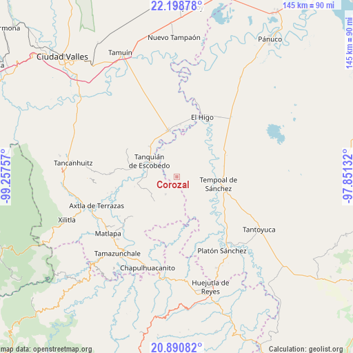
Corozal GPS coordinates[2]
21° 32' 46.572" North, 98° 33' 15.984" West
| Map corner | latitude | longitude |
|---|---|---|
| Upper-left | 22.19878°, | -99.25757° |
| Center: | 21.54627°, | -98.55444° |
| Lower-right: | 20.89082°, | -97.85132° |
| Map W x H: | 145.4×145.4 km | = 90.3×90.3mi |
| max Lat: | 32.7° ⇑18.3% North |
| Corozal: | 21.54627° |
| min Lat: | ⇓81.7% South 14.53588° |
| min Long | Corozal | max Long |
| -117.105° | -98.55444° | -86.73105° |
| W 56.6%⇐ | ⇒43.4% E |
Elevation
Elevation of Corozal is 131 m = 430 ft, and this is 1122.7 m = 3683 ft below average elevation for this country.
| Max E: |
3497 m = 11473 ft | 78% |
| Avg. | 1253.7 m = 4113 ft | |
| Corozal | 131 m = 430 ft | |
Min E: |
-1 m = -3 ft | 22% |
See also: Mexico elevation on elevation.city.
Geographical zone
Corozal is located in North Torrid zone (between Equator and Tropic of Cancer). Distance of this Northern Tropic circle is 210.2 km =130.6 mi to North.| Distance of | km | miles | from Corozal |
|---|---|---|---|
| North Pole | 7611.3 | 4729.4 | to North |
| Arctic Circle | 5005.5 | 3110.3 | to North |
| Tropic Cancer | 210.2 | 130.6 | to North |
| Equator | 2395.7 | 1488.6 | to South |


Nearby cities:
15 places around Corozal: (largest is in red/bold)
• Bellavista
18.8 km =11.7 mi,  27°
27°
• El Aguacate Terrero
19.5 km =12.1 mi,  137°
137°
• El Carrizal
20.7 km =12.9 mi,  287°
287°
• El Hoxton
19.3 km =12 mi,  13°
13°
• El Huayal
8.5 km =5.3 mi,  212°
212°
• El Hule Nuevo
10 km =6.2 mi,  359°
359°
• El Sasub
21.6 km =13.4 mi,  4°
4°
• El Álamo
21 km =13 mi, 0°
• Las Lomas
17.7 km =11 mi,  303°
303°
• Las Piedras
21.3 km =13.2 mi,  165°
165°
• Sagrada Familia
16.7 km =10.4 mi,  318°
318°
• San Vicente Tancuayalab
19.5 km =12.1 mi,  349°
349°
• Santa Elena
20.5 km =12.7 mi, 320°
• Tanquián de Escobedo
13 km =8.1 mi, 300°
• Tempoal de Sánchez
17.4 km =10.8 mi,  99°
99°
Sources, notices
• [Note1] Compared only with cities in Mexico existing in our database
• [Src1] Map data: © OpenStreetMap contributors (CC-BY-SA)
• [Src2] Other city data from geonames.org with taken over terms of usage.
• [Src3] Geographical zone / Annual Mean Temperature by Robert A. Rohde @ Wikipedia
