Coacoyula de Álvarez geodata
Coacoyula de Álvarez (Guerrero) is a populated place; located in Mexico in America/Mexico_City (GMT-6) time zone. With population of 2,744 people, there are 3225 cities with bigger population in this country. Compared to other cities in Mexico, 77.8% of cities are located further ↑North; 59.1% of cities are located further →East and 62.2% of cities have higher elevation than Coacoyula de Álvarez. Note1


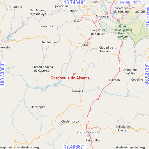
Coacoyula de Álvarez GPS coordinates[2]
18° 4' 34.86" North, 99° 37' 49.8" West
| Map corner | latitude | longitude |
|---|---|---|
| Upper-left | 18.74349°, | -100.33363° |
| Center: | 18.07635°, | -99.6305° |
| Lower-right: | 17.40667°, | -98.92738° |
| Map W x H: | 148.6×148.6 km | = 92.3×92.3mi |
| max Lat: | 32.7° ⇑77.8% North |
| Coacoyula de Álvarez: | 18.07635° |
| min Lat: | ⇓22.2% South 14.53588° |
| min Long | Coacoyula de Á | max Long |
| -117.105° | -99.6305° | -86.73105° |
| W 40.9%⇐ | ⇒59.1% E |
Elevation
Elevation of Coacoyula de Álvarez is 873 m = 2864 ft, and this is 380.7 m = 1249 ft below average elevation for this country.
| Max E: |
3497 m = 11473 ft | 62.2% |
| Avg. | 1253.7 m = 4113 ft | |
| Coacoyula de Álvarez | 873 m = 2864 ft | |
Min E: |
-1 m = -3 ft | 37.8% |
See also: Mexico elevation on elevation.city.
Geographical zone
Coacoyula de Álvarez is located in North Torrid zone (between Equator and Tropic of Cancer). Distance of this Northern Tropic circle is 596 km =370.3 mi to North.| Distance of | km | miles | from Coacoyula de Álvarez |
|---|---|---|---|
| North Pole | 7997.2 | 4969.2 | to North |
| Arctic Circle | 5391.3 | 3350 | to North |
| Tropic Cancer | 596 | 370.3 | to North |
| Equator | 2009.9 | 1248.9 | to South |


Nearby cities:
15 places around Coacoyula de Álvarez: (largest is in red/bold)
• Ahuehuepan
15.9 km =9.9 mi,  119°
119°
• Apipilulco
13.5 km =8.4 mi,  341°
341°
• Atlixtac
14.7 km =9.1 mi, 341°
• Atzcala
11.5 km =7.1 mi,  197°
197°
• Maxela
4.5 km =2.8 mi, 123°
• Mezcala
16.3 km =10.1 mi,  169°
169°
• Nuevo Balsas
14.4 km =8.9 mi,  250°
250°
• Palula
9.9 km =6.2 mi,  77°
77°
• Sabana Grande
12.5 km =7.8 mi,  43°
43°
• Sasamulco
10.8 km =6.7 mi,  32°
32°
• Tecuexcontitlán (Tecoescontitlán)
9.2 km =5.7 mi, 37°
• Tlanipatlán
15.4 km =9.6 mi,  306°
306°
• Tonalapa del Sur
7.9 km =4.9 mi,  72°
72°
• Venta de Palula
9.3 km =5.8 mi, 65°
• Xalitla
12.6 km =7.8 mi,  133°
133°
Sources, notices
• [Note1] Compared only with cities in Mexico existing in our database
• [Src1] Map data: © OpenStreetMap contributors (CC-BY-SA)
• [Src2] Other city data from geonames.org with taken over terms of usage.
• [Src3] Geographical zone / Annual Mean Temperature by Robert A. Rohde @ Wikipedia
