Nuevo Balsas geodata
Nuevo Balsas (Guerrero) is a populated place; located in Mexico in America/Mexico_City (GMT-6) time zone. With population of 1,711 people, there are 5078 cities with bigger population in this country. Compared to other cities in Mexico, 78.3% of cities are located further ↑North; 60.9% of cities are located further →East and 68.7% of cities have higher elevation than Nuevo Balsas. Note1


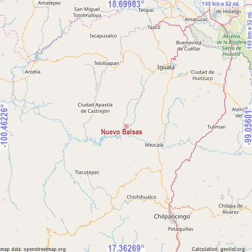
Nuevo Balsas GPS coordinates[2]
18° 1' 57.108" North, 99° 45' 32.868" West
| Map corner | latitude | longitude |
|---|---|---|
| Upper-left | 18.69983°, | -100.46226° |
| Center: | 18.03253°, | -99.75913° |
| Lower-right: | 17.36269°, | -99.05601° |
| Map W x H: | 148.7×148.7 km | = 92.4×92.4mi |
| max Lat: | 32.7° ⇑78.3% North |
| Nuevo Balsas: | 18.03253° |
| min Lat: | ⇓21.7% South 14.53588° |
| min Long | Nuevo Balsas | max Long |
| -117.105° | -99.75913° | -86.73105° |
| W 39.1%⇐ | ⇒60.9% E |
Elevation
Elevation of Nuevo Balsas is 487 m = 1598 ft, and this is 766.7 m = 2515 ft below average elevation for this country.
| Max E: |
3497 m = 11473 ft | 68.7% |
| Avg. | 1253.7 m = 4113 ft | |
| Nuevo Balsas | 487 m = 1598 ft | |
Min E: |
-1 m = -3 ft | 31.3% |
See also: Mexico elevation on elevation.city.
Geographical zone
Nuevo Balsas is located in North Torrid zone (between Equator and Tropic of Cancer). Distance of this Northern Tropic circle is 600.9 km =373.4 mi to North.| Distance of | km | miles | from Nuevo Balsas |
|---|---|---|---|
| North Pole | 8002 | 4972.2 | to North |
| Arctic Circle | 5396.1 | 3353 | to North |
| Tropic Cancer | 600.9 | 373.4 | to North |
| Equator | 2005 | 1245.8 | to South |


Nearby cities:
15 places around Nuevo Balsas: (largest is in red/bold)
• Acatlán del Río
18.4 km =11.4 mi,  234°
234°
• Ahuaxotitla
12.9 km =8 mi,  349°
349°
• Apaxtla de Castrejón
21.4 km =13.3 mi,  300°
300°
• Apetlanca
19.7 km =12.2 mi, 350°
• Apipilulco
19.9 km =12.4 mi,  27°
27°
• Atlixtac
20.8 km =12.9 mi, 25°
• Atzcala
11.9 km =7.4 mi,  120°
120°
• Carrizalillo
20.8 km =12.9 mi,  166°
166°
• Coacoyula de Álvarez
14.4 km =8.9 mi,  70°
70°
• Cuaxilotla
18.3 km =11.4 mi,  327°
327°
• Cuetzala del Progreso
13.7 km =8.5 mi, 325°
• Maxela
17.5 km =10.9 mi,  82°
82°
• Mezcala
20 km =12.4 mi, 123°
• Tianquizolco
21.2 km =13.2 mi,  1°
1°
• Tlanipatlán
14.1 km =8.8 mi, 4°
Sources, notices
• [Note1] Compared only with cities in Mexico existing in our database
• [Src1] Map data: © OpenStreetMap contributors (CC-BY-SA)
• [Src2] Other city data from geonames.org with taken over terms of usage.
• [Src3] Geographical zone / Annual Mean Temperature by Robert A. Rohde @ Wikipedia
