Sasamulco geodata
Sasamulco (Guerrero) is a populated place; located in Mexico in America/Mexico_City (GMT-6) time zone. With population of 737 people, there are 11858 cities with bigger population in this country. Compared to other cities in Mexico, 76.7% of cities are located further ↑North; 58.1% of cities are located further →East and 62.6% of cities have higher elevation than Sasamulco. Note1


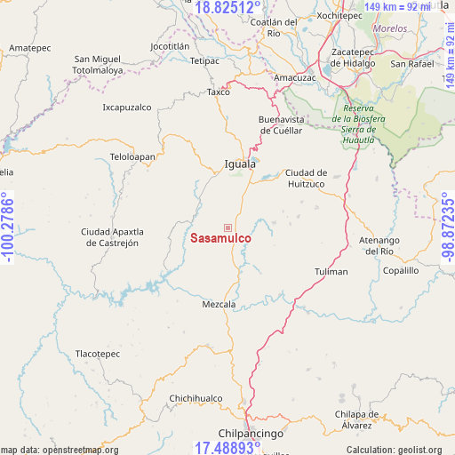
Sasamulco GPS coordinates[2]
18° 9' 29.88" North, 99° 34' 31.692" West
| Map corner | latitude | longitude |
|---|---|---|
| Upper-left | 18.82512°, | -100.2786° |
| Center: | 18.1583°, | -99.57547° |
| Lower-right: | 17.48893°, | -98.87235° |
| Map W x H: | 148.6×148.6 km | = 92.3×92.3mi |
| max Lat: | 32.7° ⇑76.7% North |
| Sasamulco: | 18.1583° |
| min Lat: | ⇓23.3% South 14.53588° |
| min Long | Sasamulco | max Long |
| -117.105° | -99.57547° | -86.73105° |
| W 41.9%⇐ | ⇒58.1% E |
Elevation
Elevation of Sasamulco is 842 m = 2762 ft, and this is 411.7 m = 1351 ft below average elevation for this country.
| Max E: |
3497 m = 11473 ft | 62.6% |
| Avg. | 1253.7 m = 4113 ft | |
| Sasamulco | 842 m = 2762 ft | |
Min E: |
-1 m = -3 ft | 37.4% |
See also: Mexico elevation on elevation.city.
Geographical zone
Sasamulco is located in North Torrid zone (between Equator and Tropic of Cancer). Distance of this Northern Tropic circle is 586.9 km =364.7 mi to North.| Distance of | km | miles | from Sasamulco |
|---|---|---|---|
| North Pole | 7988 | 4963.5 | to North |
| Arctic Circle | 5382.2 | 3344.3 | to North |
| Tropic Cancer | 586.9 | 364.7 | to North |
| Equator | 2019 | 1254.5 | to South |


Nearby cities:
15 places around Sasamulco: (largest is in red/bold)
• Acayahualco
12.5 km =7.8 mi,  53°
53°
• Apango
13.8 km =8.6 mi,  308°
308°
• Apipilulco
10.8 km =6.7 mi,  289°
289°
• Atlixtac
11.5 km =7.1 mi, 294°
• Coacoyula de Álvarez
10.8 km =6.7 mi,  212°
212°
• Cocula
13 km =8.1 mi,  315°
315°
• Maxela
11.8 km =7.3 mi,  189°
189°
• Palula
7.9 km =4.9 mi,  151°
151°
• Rincón de la Cocina
14.9 km =9.3 mi, 50°
• Sabana Grande
2.8 km =1.7 mi,  91°
91°
• Santa Teresa
10.7 km =6.6 mi,  42°
42°
• Tecuexcontitlán (Tecoescontitlán)
1.8 km =1.1 mi, 188°
• Tonalapa del Sur
7 km =4.3 mi,  165°
165°
• Venta de Palula
5.9 km =3.7 mi, 153°
• Zacacoyuca
11.4 km =7.1 mi,  26°
26°
Sources, notices
• [Note1] Compared only with cities in Mexico existing in our database
• [Src1] Map data: © OpenStreetMap contributors (CC-BY-SA)
• [Src2] Other city data from geonames.org with taken over terms of usage.
• [Src3] Geographical zone / Annual Mean Temperature by Robert A. Rohde @ Wikipedia
