Villa Cuauhtémoc geodata
Villa Cuauhtémoc (Puebla) is a populated place; located in Mexico in America/Mexico_City (GMT-6) time zone. With population of 1,193 people, there are 7278 cities with bigger population in this country. Compared to other cities in Mexico, 52.2% of cities are located further ↓South; 62.5% of cities are located further ←West and 90% of cities have lower elevation than Villa Cuauhtémoc. Note1


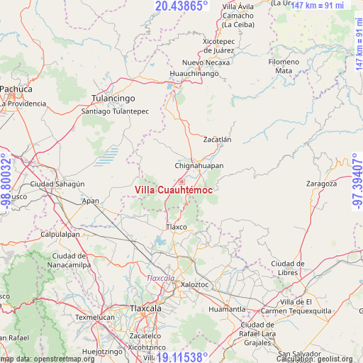
Villa Cuauhtémoc GPS coordinates[2]
19° 46' 42.204" North, 98° 5' 49.884" West
| Map corner | latitude | longitude |
|---|---|---|
| Upper-left | 20.43865°, | -98.80032° |
| Center: | 19.77839°, | -98.09719° |
| Lower-right: | 19.11538°, | -97.39407° |
| Map W x H: | 147.1×147.1 km | = 91.4×91.4mi |
| max Lat: | 32.7° ⇑47.8% North |
| Villa Cuauhtémoc: | 19.77839° |
| min Lat: | ⇓52.2% South 14.53588° |
| min Long | Villa Cuauhtém | max Long |
| -117.105° | -98.09719° | -86.73105° |
| W 62.5%⇐ | ⇒37.5% E |
Elevation
Elevation of Villa Cuauhtémoc is 2407 m = 7897 ft, and this is 1153.3 m = 3784 ft above average elevation for this country.
| Max E: |
3497 m = 11473 ft | 10% |
| Villa Cuauhtémoc | 2407 m 7897 ft | |
| Avg. | 1253.7 m = 4113 ft | |
Min E: |
-1 m = -3 ft | 90% |
See also: Mexico elevation on elevation.city.
Geographical zone
Villa Cuauhtémoc is located in North Torrid zone (between Equator and Tropic of Cancer). Distance of this Northern Tropic circle is 406.8 km =252.8 mi to North.| Distance of | km | miles | from Villa Cuauhtémoc |
|---|---|---|---|
| North Pole | 7807.9 | 4851.6 | to North |
| Arctic Circle | 5202 | 3232.4 | to North |
| Tropic Cancer | 406.8 | 252.8 | to North |
| Equator | 2199.2 | 1366.5 | to South |


Nearby cities:
15 places around Villa Cuauhtémoc: (largest is in red/bold)
• Acolihuia
3 km =1.9 mi,  282°
282°
• Chignahuapan
9.6 km =6 mi,  45°
45°
• Coacoyunga
8.2 km =5.1 mi,  61°
61°
• El Fresno
5.7 km =3.5 mi,  159°
159°
• Ixtlahuaca Barrio
11 km =6.8 mi, 52°
• Llano Verde
3.4 km =2.1 mi,  231°
231°
• Loma Alta
7.6 km =4.7 mi,  74°
74°
• Los Ranchos (Rinconada)
12.1 km =7.5 mi,  238°
238°
• Lázaro Cárdenas (Tzitla)
6.2 km =3.9 mi, 47°
• Matlahuacales Aquiles Serdán
4.9 km =3 mi,  111°
111°
• Michac
9.5 km =5.9 mi,  30°
30°
• Rinconada
11.9 km =7.4 mi, 233°
• San Antonio Matlahuacales
3 km =1.9 mi,  148°
148°
• Sebastopol
7.9 km =4.9 mi,  89°
89°
• Tenextla
10.9 km =6.8 mi, 55°
Sources, notices
• [Note1] Compared only with cities in Mexico existing in our database
• [Src1] Map data: © OpenStreetMap contributors (CC-BY-SA)
• [Src2] Other city data from geonames.org with taken over terms of usage.
• [Src3] Geographical zone / Annual Mean Temperature by Robert A. Rohde @ Wikipedia
