San Antonio Matlahuacales geodata
San Antonio Matlahuacales (Puebla) is a populated place; located in Mexico in America/Mexico_City (GMT-6) time zone. With population of 1,217 people, there are 7142 cities with bigger population in this country. Compared to other cities in Mexico, 51.6% of cities are located further ↓South; 62.6% of cities are located further ←West and 93% of cities have lower elevation than San Antonio Matlahuacales. Note1
Current local time in San Antonio Matlahuacales:
06:50 AM, WednesdayDifference from your time zone: hours


San Antonio Matlahuacales GPS coordinates[2]
19° 45' 19.008" North, 98° 4' 54.984" West
| Map corner | latitude | longitude |
|---|---|---|
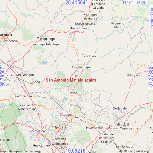
| Upper-left | 20.41564°, | -98.78507° |
| Center: | 19.75528°, | -98.08194° |
| Lower-right: | 19.09218°, | -97.37882° |
| Map W x H: | 147.2×147.2 km | = 91.5×91.5mi |
| max Lat: | 32.7° ⇑48.4% North |
| San Antonio Matlahuacales: | 19.75528° |
| min Lat: | ⇓51.6% South 14.53588° |
| min Long | San Antonio Mat | max Long |
| -117.105° | -98.08194° | -86.73105° |
| W 62.6%⇐ | ⇒37.4% E |
Elevation
Elevation of San Antonio Matlahuacales is 2527 m = 8291 ft, and this is 1273.3 m = 4177 ft above average elevation for this country.
| Max E: |
3497 m = 11473 ft | 7% |
| San Antonio Matlahuacales | 2527 m 8291 ft | |
| Avg. | 1253.7 m = 4113 ft | |
Min E: |
-1 m = -3 ft | 93% |
See also: Mexico elevation on elevation.city.
Geographical zone
San Antonio Matlahuacales is located in North Torrid zone (between Equator and Tropic of Cancer). Distance of this Northern Tropic circle is 409.3 km =254.3 mi to North.| Distance of | km | miles | from San Antonio Matlahuacales |
|---|---|---|---|
| North Pole | 7810.5 | 4853.2 | to North |
| Arctic Circle | 5204.6 | 3234 | to North |
| Tropic Cancer | 409.3 | 254.3 | to North |
| Equator | 2196.6 | 1364.9 | to South |


Nearby cities:
15 places around San Antonio Matlahuacales: (largest is in red/bold)
• Acolihuia
5.6 km =3.5 mi,  305°
305°
• Chichicaxtla
11.8 km =7.3 mi,  95°
95°
• Chignahuapan
10.7 km =6.6 mi,  29°
29°
• Coacoyunga
8.6 km =5.3 mi,  40°
40°
• El Fresno
2.8 km =1.7 mi,  171°
171°
• Ixtlahuaca Barrio
11.7 km =7.3 mi, 37°
• Llano Verde
4.2 km =2.6 mi,  276°
276°
• Loma Alta
7.4 km =4.6 mi,  50°
50°
• Lázaro Cárdenas (Tzitla)
7.4 km =4.6 mi,  23°
23°
• Matlahuacales Aquiles Serdán
3 km =1.9 mi,  75°
75°
• Michac
11.3 km =7 mi, 16°
• Rinconada
12 km =7.5 mi,  247°
247°
• Sebastopol
6.8 km =4.2 mi,  67°
67°
• Tenextla
11.4 km =7.1 mi, 40°
• Villa Cuauhtémoc
3 km =1.9 mi,  328°
328°
Sources, notices
• [Note1] Compared only with cities in Mexico existing in our database
• [Src1] Map data: © OpenStreetMap contributors (CC-BY-SA)
• [Src2] Other city data from geonames.org with taken over terms of usage.
• [Src3] Geographical zone / Annual Mean Temperature by Robert A. Rohde @ Wikipedia
