Cerro Verde geodata
Cerro Verde (Puebla) is a populated place; located in Mexico in America/Mexico_City (GMT-6) time zone. With population of 848 people, there are 10316 cities with bigger population in this country. Compared to other cities in Mexico, 64.3% of cities are located further ↓South; 66.7% of cities are located further ←West and 74.9% of cities have higher elevation than Cerro Verde. Note1


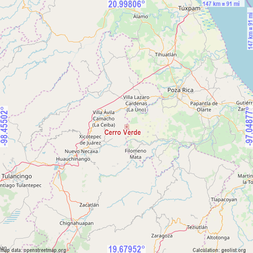
Cerro Verde GPS coordinates[2]
20° 20' 24.72" North, 97° 45' 6.804" West
| Map corner | latitude | longitude |
|---|---|---|
| Upper-left | 20.99806°, | -98.45502° |
| Center: | 20.3402°, | -97.75189° |
| Lower-right: | 19.67952°, | -97.04877° |
| Map W x H: | 146.6×146.6 km | = 91.1×91.1mi |
| max Lat: | 32.7° ⇑35.7% North |
| Cerro Verde: | 20.3402° |
| min Lat: | ⇓64.3% South 14.53588° |
| min Long | Cerro Verde | max Long |
| -117.105° | -97.75189° | -86.73105° |
| W 66.7%⇐ | ⇒33.3% E |
Elevation
Elevation of Cerro Verde is 224 m = 735 ft, and this is 1029.7 m = 3378 ft below average elevation for this country.
| Max E: |
3497 m = 11473 ft | 74.9% |
| Avg. | 1253.7 m = 4113 ft | |
| Cerro Verde | 224 m = 735 ft | |
Min E: |
-1 m = -3 ft | 25.1% |
See also: Mexico elevation on elevation.city.
Geographical zone
Cerro Verde is located in North Torrid zone (between Equator and Tropic of Cancer). Distance of this Northern Tropic circle is 344.3 km =213.9 mi to North.| Distance of | km | miles | from Cerro Verde |
|---|---|---|---|
| North Pole | 7745.4 | 4812.8 | to North |
| Arctic Circle | 5139.6 | 3193.6 | to North |
| Tropic Cancer | 344.3 | 213.9 | to North |
| Equator | 2261.6 | 1405.3 | to South |


Nearby cities:
15 places around Cerro Verde: (largest is in red/bold)
• Apapantilla
12.1 km =7.5 mi,  305°
305°
• Chicualoque
10.5 km =6.5 mi,  63°
63°
• Coahuitlán
9.2 km =5.7 mi,  165°
165°
• Cruz Verde
11.2 km =7 mi,  121°
121°
• El Tepetate
10.3 km =6.4 mi,  339°
339°
• La Palma
7.8 km =4.8 mi,  359°
359°
• Macedonio Alonso
9.6 km =6 mi,  139°
139°
• Nuevo Zoquiapan
10.9 km =6.8 mi,  354°
354°
• Paso de Coyutla
12 km =7.5 mi,  26°
26°
• Piedras Negras
11.3 km =7 mi, 354°
• Progreso de Zaragoza
8.4 km =5.2 mi,  149°
149°
• Santa Rita
7.3 km =4.5 mi,  291°
291°
• Tenangulto
3.7 km =2.3 mi,  244°
244°
• Tlaxcalantongo
12.9 km =8 mi,  256°
256°
• Tulapilla
12.9 km =8 mi,  104°
104°
Sources, notices
• [Note1] Compared only with cities in Mexico existing in our database
• [Src1] Map data: © OpenStreetMap contributors (CC-BY-SA)
• [Src2] Other city data from geonames.org with taken over terms of usage.
• [Src3] Geographical zone / Annual Mean Temperature by Robert A. Rohde @ Wikipedia
