Camotepec geodata
Camotepec (Puebla) is a populated place; located in Mexico in America/Mexico_City (GMT-6) time zone. With population of 2,364 people, there are 3734 cities with bigger population in this country. Compared to other cities in Mexico, 58% of cities are located further ↓South; 62.8% of cities are located further ←West and 91.9% of cities have lower elevation than Camotepec. Note1


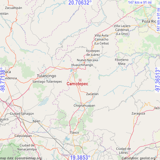
Camotepec GPS coordinates[2]
20° 2' 49.92" North, 98° 4' 5.7" West
| Map corner | latitude | longitude |
|---|---|---|
| Upper-left | 20.70632°, | -98.77138° |
| Center: | 20.0472°, | -98.06825° |
| Lower-right: | 19.3853°, | -97.36513° |
| Map W x H: | 146.9×146.9 km | = 91.3×91.3mi |
| max Lat: | 32.7° ⇑42% North |
| Camotepec: | 20.0472° |
| min Lat: | ⇓58% South 14.53588° |
| min Long | Camotepec | max Long |
| -117.105° | -98.06825° | -86.73105° |
| W 62.8%⇐ | ⇒37.2% E |
Elevation
Elevation of Camotepec is 2478 m = 8130 ft, and this is 1224.3 m = 4017 ft above average elevation for this country.
| Max E: |
3497 m = 11473 ft | 8.1% |
| Camotepec | 2478 m 8130 ft | |
| Avg. | 1253.7 m = 4113 ft | |
Min E: |
-1 m = -3 ft | 91.9% |
See also: Mexico elevation on elevation.city.
Geographical zone
Camotepec is located in North Torrid zone (between Equator and Tropic of Cancer). Distance of this Northern Tropic circle is 376.9 km =234.2 mi to North.| Distance of | km | miles | from Camotepec |
|---|---|---|---|
| North Pole | 7778 | 4833 | to North |
| Arctic Circle | 5172.1 | 3213.8 | to North |
| Tropic Cancer | 376.9 | 234.2 | to North |
| Equator | 2229 | 1385 | to South |


Nearby cities:
15 places around Camotepec: (largest is in red/bold)
• Ahuazotepec
9.9 km =6.2 mi,  268°
268°
• Atotonilco
8.6 km =5.3 mi,  231°
231°
• Beristain
8.5 km =5.3 mi,  307°
307°
• La Boveda
10.5 km =6.5 mi,  325°
325°
• La Estación de Ahuazotepec
8.7 km =5.4 mi, 272°
• Laguna Seca
6 km =3.7 mi,  262°
262°
• Las Lajas
5.5 km =3.4 mi,  185°
185°
• Las Lajas Primera Sección
4.9 km =3 mi,  208°
208°
• Mesa de Capulines
8.9 km =5.5 mi,  323°
323°
• Metepec
7 km =4.3 mi,  171°
171°
• Nanacamila
6.6 km =4.1 mi, 231°
• Teopancingo
5.2 km =3.2 mi,  358°
358°
• Tlaxco (Santiago Tlaxco)
11.1 km =6.9 mi,  83°
83°
• Venta Grande
8.6 km =5.3 mi,  337°
337°
• Zempoala
8.5 km =5.3 mi,  58°
58°
Sources, notices
• [Note1] Compared only with cities in Mexico existing in our database
• [Src1] Map data: © OpenStreetMap contributors (CC-BY-SA)
• [Src2] Other city data from geonames.org with taken over terms of usage.
• [Src3] Geographical zone / Annual Mean Temperature by Robert A. Rohde @ Wikipedia
