Ahuazotepec geodata
Ahuazotepec (Puebla) is a seat of a second-order administrative division; located in Mexico in America/Mexico_City (GMT-6) time zone. With population of 2,351 people, there are 3756 cities with bigger population in this country. Compared to other cities in Mexico, 57.9% of cities are located further ↓South; 61.8% of cities are located further ←West and 86.4% of cities have lower elevation than Ahuazotepec. Note1


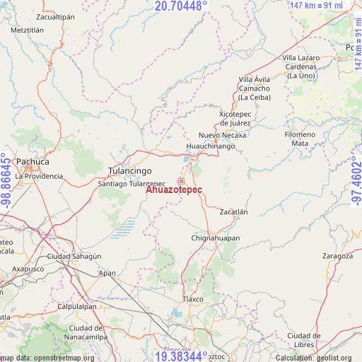
Ahuazotepec GPS coordinates[2]
20° 2' 43.26" North, 98° 9' 47.952" West
| Map corner | latitude | longitude |
|---|---|---|
| Upper-left | 20.70448°, | -98.86645° |
| Center: | 20.04535°, | -98.16332° |
| Lower-right: | 19.38344°, | -97.4602° |
| Map W x H: | 146.9×146.9 km | = 91.3×91.3mi |
| max Lat: | 32.7° ⇑42.1% North |
| Ahuazotepec: | 20.04535° |
| min Lat: | ⇓57.9% South 14.53588° |
| min Long | Ahuazotepec | max Long |
| -117.105° | -98.16332° | -86.73105° |
| W 61.8%⇐ | ⇒38.2% E |
Elevation
Elevation of Ahuazotepec is 2294 m = 7526 ft, and this is 1040.3 m = 3413 ft above average elevation for this country.
| Max E: |
3497 m = 11473 ft | 13.6% |
| Ahuazotepec | 2294 m 7526 ft | |
| Avg. | 1253.7 m = 4113 ft | |
Min E: |
-1 m = -3 ft | 86.4% |
See also: Mexico elevation on elevation.city.
Geographical zone
Ahuazotepec is located in North Torrid zone (between Equator and Tropic of Cancer). Distance of this Northern Tropic circle is 377.1 km =234.3 mi to North.| Distance of | km | miles | from Ahuazotepec |
|---|---|---|---|
| North Pole | 7778.2 | 4833.1 | to North |
| Arctic Circle | 5172.3 | 3213.9 | to North |
| Tropic Cancer | 377.1 | 234.3 | to North |
| Equator | 2228.8 | 1384.9 | to South |


Nearby cities:
15 places around Ahuazotepec: (largest is in red/bold)
• Atotonilco
6 km =3.7 mi,  147°
147°
• Beristain
6.3 km =3.9 mi,  30°
30°
• Camotepec
9.9 km =6.2 mi,  88°
88°
• Coyametepec
8.5 km =5.3 mi,  335°
335°
• Hueyapita
8.7 km =5.4 mi,  289°
289°
• La Boveda
9.7 km =6 mi,  24°
24°
• La Estación de Ahuazotepec
1.4 km =0.9 mi,  66°
66°
• La Mesa
8.2 km =5.1 mi,  307°
307°
• Laguna Seca
4 km =2.5 mi,  98°
98°
• Las Lajas Primera Sección
8.7 km =5.4 mi,  118°
118°
• Las Puentes
2.3 km =1.4 mi,  268°
268°
• Mesa de Capulines
8.8 km =5.5 mi, 32°
• Nanacamila
6.2 km =3.9 mi,  129°
129°
• Santa Elena Paliseca
9.7 km =6 mi,  237°
237°
• Tepepa
9.9 km =6.2 mi,  355°
355°
Sources, notices
• [Note1] Compared only with cities in Mexico existing in our database
• [Src1] Map data: © OpenStreetMap contributors (CC-BY-SA)
• [Src2] Other city data from geonames.org with taken over terms of usage.
• [Src3] Geographical zone / Annual Mean Temperature by Robert A. Rohde @ Wikipedia
