Cochoapa geodata
Cochoapa (Guerrero) is a populated place; located in Mexico in America/Mexico_City (GMT-6) time zone. With population of 4,237 people, there are 2168 cities with bigger population in this country. Compared to other cities in Mexico, 92.6% of cities are located further ↑North; 59% of cities are located further ←West and 70.4% of cities have higher elevation than Cochoapa. Note1


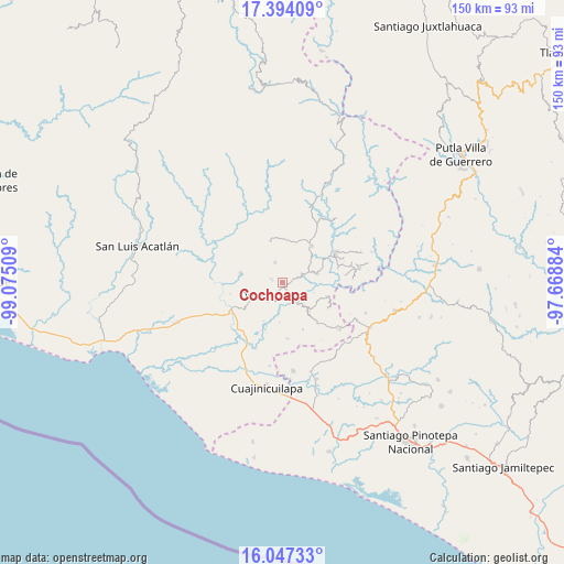
Cochoapa GPS coordinates[2]
16° 43' 18.84" North, 98° 22' 19.056" West
| Map corner | latitude | longitude |
|---|---|---|
| Upper-left | 17.39409°, | -99.07509° |
| Center: | 16.7219°, | -98.37196° |
| Lower-right: | 16.04733°, | -97.66884° |
| Map W x H: | 149.7×149.7 km | = 93×93mi |
| max Lat: | 32.7° ⇑92.6% North |
| Cochoapa: | 16.7219° |
| min Lat: | ⇓7.4% South 14.53588° |
| min Long | Cochoapa | max Long |
| -117.105° | -98.37196° | -86.73105° |
| W 59%⇐ | ⇒41% E |
Elevation
Elevation of Cochoapa is 397 m = 1302 ft, and this is 856.7 m = 2811 ft below average elevation for this country.
| Max E: |
3497 m = 11473 ft | 70.4% |
| Avg. | 1253.7 m = 4113 ft | |
| Cochoapa | 397 m = 1302 ft | |
Min E: |
-1 m = -3 ft | 29.6% |
See also: Mexico elevation on elevation.city.
Geographical zone
Cochoapa is located in North Torrid zone (between Equator and Tropic of Cancer). Distance of this Northern Tropic circle is 746.6 km =463.9 mi to North.| Distance of | km | miles | from Cochoapa |
|---|---|---|---|
| North Pole | 8147.8 | 5062.8 | to North |
| Arctic Circle | 5541.9 | 3443.6 | to North |
| Tropic Cancer | 746.6 | 463.9 | to North |
| Equator | 1859.3 | 1155.3 | to South |


Nearby cities:
15 places around Cochoapa: (largest is in red/bold)
• Acatepec
6.2 km =3.9 mi,  286°
286°
• Cruz Verde II
8.7 km =5.4 mi,  107°
107°
• Cruz de Corazón
8.1 km =5 mi,  246°
246°
• Cumbre de Barranca Honda
3.9 km =2.4 mi,  73°
73°
• Huixtepec
10.5 km =6.5 mi,  136°
136°
• Igualapa
11.5 km =7.1 mi,  283°
283°
• La Guadalupe
12.3 km =7.6 mi, 107°
• La Soledad
3.5 km =2.2 mi, 288°
• Las Vigas
10.3 km =6.4 mi,  240°
240°
• Llano Grande de los Hilarios
8.4 km =5.2 mi,  300°
300°
• Ometepec
5.2 km =3.2 mi,  227°
227°
• San Cristóbal
11.6 km =7.2 mi,  343°
343°
• Santa María
5.7 km =3.5 mi, 339°
• Villa Hidalgo
2.8 km =1.7 mi, 279°
• Zacoalpan
9.3 km =5.8 mi, 74°
Sources, notices
• [Note1] Compared only with cities in Mexico existing in our database
• [Src1] Map data: © OpenStreetMap contributors (CC-BY-SA)
• [Src2] Other city data from geonames.org with taken over terms of usage.
• [Src3] Geographical zone / Annual Mean Temperature by Robert A. Rohde @ Wikipedia
