Arroyo Jerusalén geodata
Arroyo Jerusalén (Chiapas) is a populated place; located in Mexico in America/Mexico_City (GMT-6) time zone. With population of 589 people, there are 14579 cities with bigger population in this country. Compared to other cities in Mexico, 87.6% of cities are located further ↑North; 96.6% of cities are located further ←West and 79.7% of cities have higher elevation than Arroyo Jerusalén. Note1


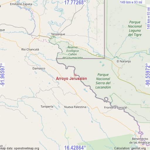
Arroyo Jerusalén GPS coordinates[2]
17° 6' 6.732" North, 91° 15' 46.224" West
| Map corner | latitude | longitude |
|---|---|---|
| Upper-left | 17.77268°, | -91.96597° |
| Center: | 17.10187°, | -91.26284° |
| Lower-right: | 16.42864°, | -90.55972° |
| Map W x H: | 149.4×149.4 km | = 92.8×92.8mi |
| max Lat: | 32.7° ⇑87.6% North |
| Arroyo Jerusalén: | 17.10187° |
| min Lat: | ⇓12.4% South 14.53588° |
| min Long | Arroyo Jerusal� | max Long |
| -117.105° | -91.26284° | -86.73105° |
| W 96.6%⇐ | ⇒3.4% E |
Elevation
Elevation of Arroyo Jerusalén is 99 m = 325 ft, and this is 1154.7 m = 3788 ft below average elevation for this country.
| Max E: |
3497 m = 11473 ft | 79.7% |
| Avg. | 1253.7 m = 4113 ft | |
| Arroyo Jerusalén | 99 m = 325 ft | |
Min E: |
-1 m = -3 ft | 20.3% |
See also: Mexico elevation on elevation.city.
Geographical zone
Arroyo Jerusalén is located in North Torrid zone (between Equator and Tropic of Cancer). Distance of this Northern Tropic circle is 704.4 km =437.7 mi to North.| Distance of | km | miles | from Arroyo Jerusalén |
|---|---|---|---|
| North Pole | 8105.5 | 5036.5 | to North |
| Arctic Circle | 5499.6 | 3417.3 | to North |
| Tropic Cancer | 704.4 | 437.7 | to North |
| Equator | 1901.5 | 1181.5 | to South |


Nearby cities:
15 places around Arroyo Jerusalén: (largest is in red/bold)
• Arroyo Granizo
18.7 km =11.6 mi,  247°
247°
• Busiljá
11.5 km =7.1 mi, 246°
• Cintalapa
22.4 km =13.9 mi,  207°
207°
• El Limonar
19.1 km =11.9 mi,  219°
219°
• Francisco Guerrero
24 km =14.9 mi,  277°
277°
• Ignacio Allende
22.8 km =14.2 mi,  11°
11°
• La Arena
27.6 km =17.1 mi,  272°
272°
• Nueva Libertad
4.8 km =3 mi, 268°
• Nuevo Francisco León
10.2 km =6.3 mi, 218°
• Nuevo Mariscal
16 km =9.9 mi,  148°
148°
• Ojo de Agua
23.9 km =14.9 mi,  259°
259°
• Redención del Campesino
25.2 km =15.7 mi,  354°
354°
• Santo Domingo
18.3 km =11.4 mi,  243°
243°
• Ubilio García
22.4 km =13.9 mi, 264°
• Álvaro Obregón
21.2 km =13.2 mi, 9°
Sources, notices
• [Note1] Compared only with cities in Mexico existing in our database
• [Src1] Map data: © OpenStreetMap contributors (CC-BY-SA)
• [Src2] Other city data from geonames.org with taken over terms of usage.
• [Src3] Geographical zone / Annual Mean Temperature by Robert A. Rohde @ Wikipedia
