La Arena geodata
La Arena (Chiapas) is a populated place; located in Mexico in America/Mexico_City (GMT-6) time zone. With population of 761 people, there are 11509 cities with bigger population in this country. Compared to other cities in Mexico, 87.5% of cities are located further ↑North; 96.3% of cities are located further ←West and 70.5% of cities have higher elevation than La Arena. Note1


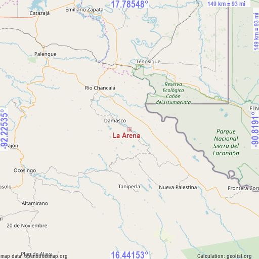
La Arena GPS coordinates[2]
17° 6' 52.992" North, 91° 31' 19.992" West
| Map corner | latitude | longitude |
|---|---|---|
| Upper-left | 17.78548°, | -92.22535° |
| Center: | 17.11472°, | -91.52222° |
| Lower-right: | 16.44153°, | -90.8191° |
| Map W x H: | 149.4×149.4 km | = 92.8×92.8mi |
| max Lat: | 32.7° ⇑87.5% North |
| La Arena: | 17.11472° |
| min Lat: | ⇓12.5% South 14.53588° |
| min Long | La Arena | max Long |
| -117.105° | -91.52222° | -86.73105° |
| W 96.3%⇐ | ⇒3.7% E |
Elevation
Elevation of La Arena is 390 m = 1280 ft, and this is 863.7 m = 2834 ft below average elevation for this country.
| Max E: |
3497 m = 11473 ft | 70.5% |
| Avg. | 1253.7 m = 4113 ft | |
| La Arena | 390 m = 1280 ft | |
Min E: |
-1 m = -3 ft | 29.5% |
See also: Mexico elevation on elevation.city.
Geographical zone
La Arena is located in North Torrid zone (between Equator and Tropic of Cancer). Distance of this Northern Tropic circle is 702.9 km =436.8 mi to North.| Distance of | km | miles | from La Arena |
|---|---|---|---|
| North Pole | 8104.1 | 5035.7 | to North |
| Arctic Circle | 5498.2 | 3416.4 | to North |
| Tropic Cancer | 702.9 | 436.8 | to North |
| Equator | 1903 | 1182.5 | to South |


Nearby cities:
15 places around La Arena: (largest is in red/bold)
• Arroyo Granizo
13.4 km =8.3 mi,  130°
130°
• Cristóbal Colón
14.2 km =8.8 mi,  307°
307°
• Damasco
9.8 km =6.1 mi,  302°
302°
• El Jardín
16.1 km =10 mi,  183°
183°
• El Sibal
15.3 km =9.5 mi,  167°
167°
• El Tumbo
11.8 km =7.3 mi,  249°
249°
• Francisco Guerrero
4.1 km =2.5 mi,  66°
66°
• Lacandón
13 km =8.1 mi,  216°
216°
• Nueva Esperanza (La Esperanza)
16.4 km =10.2 mi,  268°
268°
• Nueva Samaria
13.2 km =8.2 mi, 313°
• Nuevo Jericó
2.9 km =1.8 mi, 310°
• Ojo de Agua
7.1 km =4.4 mi,  144°
144°
• San José Pathuitz
16.9 km =10.5 mi, 298°
• Santo Domingo
14.8 km =9.2 mi, 130°
• Ubilio García
6.3 km =3.9 mi,  122°
122°
Sources, notices
• [Note1] Compared only with cities in Mexico existing in our database
• [Src1] Map data: © OpenStreetMap contributors (CC-BY-SA)
• [Src2] Other city data from geonames.org with taken over terms of usage.
• [Src3] Geographical zone / Annual Mean Temperature by Robert A. Rohde @ Wikipedia
