Ubilio García geodata
Ubilio García (Chiapas) is a populated place; located in Mexico in America/Mexico_City (GMT-6) time zone. With population of 1,318 people, there are 6582 cities with bigger population in this country. Compared to other cities in Mexico, 87.8% of cities are located further ↑North; 96.4% of cities are located further ←West and 71.1% of cities have higher elevation than Ubilio García. Note1


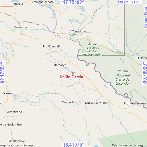
Ubilio García GPS coordinates[2]
17° 5' 2.58" North, 91° 28' 20.676" West
| Map corner | latitude | longitude |
|---|---|---|
| Upper-left | 17.75492°, | -92.17554° |
| Center: | 17.08405°, | -91.47241° |
| Lower-right: | 16.41075°, | -90.76929° |
| Map W x H: | 149.5×149.5 km | = 92.9×92.9mi |
| max Lat: | 32.7° ⇑87.8% North |
| Ubilio García: | 17.08405° |
| min Lat: | ⇓12.2% South 14.53588° |
| min Long | Ubilio García | max Long |
| -117.105° | -91.47241° | -86.73105° |
| W 96.4%⇐ | ⇒3.6% E |
Elevation
Elevation of Ubilio García is 366 m = 1201 ft, and this is 887.7 m = 2912 ft below average elevation for this country.
| Max E: |
3497 m = 11473 ft | 71.1% |
| Avg. | 1253.7 m = 4113 ft | |
| Ubilio García | 366 m = 1201 ft | |
Min E: |
-1 m = -3 ft | 28.9% |
See also: Mexico elevation on elevation.city.
Geographical zone
Ubilio García is located in North Torrid zone (between Equator and Tropic of Cancer). Distance of this Northern Tropic circle is 706.4 km =438.9 mi to North.| Distance of | km | miles | from Ubilio García |
|---|---|---|---|
| North Pole | 8107.5 | 5037.8 | to North |
| Arctic Circle | 5501.6 | 3418.5 | to North |
| Tropic Cancer | 706.4 | 438.9 | to North |
| Equator | 1899.6 | 1180.4 | to South |


Nearby cities:
15 places around Ubilio García: (largest is in red/bold)
• Arroyo Granizo
7.2 km =4.5 mi,  136°
136°
• Busiljá
12.1 km =7.5 mi,  102°
102°
• Damasco
16.1 km =10 mi,  302°
302°
• El Jardín
14.1 km =8.8 mi,  206°
206°
• El Limonar
16.1 km =10 mi, 141°
• El Sibal
11.7 km =7.3 mi,  189°
189°
• El Tumbo
16.3 km =10.1 mi,  267°
267°
• Francisco Guerrero
5.3 km =3.3 mi,  343°
343°
• La Arena
6.3 km =3.9 mi, 302°
• Lacandón
14.8 km =9.2 mi,  241°
241°
• Nueva Libertad
17.6 km =10.9 mi,  84°
84°
• Nuevo Francisco León
17.1 km =10.6 mi,  110°
110°
• Nuevo Jericó
9.2 km =5.7 mi,  305°
305°
• Ojo de Agua
2.7 km =1.7 mi, 205°
• Santo Domingo
8.6 km =5.3 mi, 136°
Sources, notices
• [Note1] Compared only with cities in Mexico existing in our database
• [Src1] Map data: © OpenStreetMap contributors (CC-BY-SA)
• [Src2] Other city data from geonames.org with taken over terms of usage.
• [Src3] Geographical zone / Annual Mean Temperature by Robert A. Rohde @ Wikipedia
