Santiago Tetepec geodata
Santiago Tetepec (Oaxaca) is a seat of a second-order administrative division; located in Mexico in America/Mexico_City (GMT-6) time zone. With population of 1,231 people, there are 7050 cities with bigger population in this country. Compared to other cities in Mexico, 95.5% of cities are located further ↑North; 66.7% of cities are located further ←West and 73.6% of cities have higher elevation than Santiago Tetepec. Note1


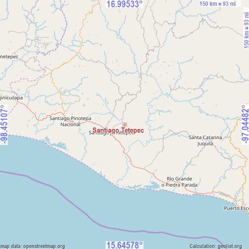
Santiago Tetepec GPS coordinates[2]
16° 19' 18.192" North, 97° 44' 52.584" West
| Map corner | latitude | longitude |
|---|---|---|
| Upper-left | 16.99533°, | -98.45107° |
| Center: | 16.32172°, | -97.74794° |
| Lower-right: | 15.64578°, | -97.04482° |
| Map W x H: | 150.1×150.1 km | = 93.3×93.3mi |
| max Lat: | 32.7° ⇑95.5% North |
| Santiago Tetepec: | 16.32172° |
| min Lat: | ⇓4.5% South 14.53588° |
| min Long | Santiago Tetepe | max Long |
| -117.105° | -97.74794° | -86.73105° |
| W 66.7%⇐ | ⇒33.3% E |
Elevation
Elevation of Santiago Tetepec is 271 m = 889 ft, and this is 982.7 m = 3224 ft below average elevation for this country.
| Max E: |
3497 m = 11473 ft | 73.6% |
| Avg. | 1253.7 m = 4113 ft | |
| Santiago Tetepec | 271 m = 889 ft | |
Min E: |
-1 m = -3 ft | 26.4% |
See also: Mexico elevation on elevation.city.
Geographical zone
Santiago Tetepec is located in North Torrid zone (between Equator and Tropic of Cancer). Distance of this Northern Tropic circle is 791.1 km =491.6 mi to North.| Distance of | km | miles | from Santiago Tetepec |
|---|---|---|---|
| North Pole | 8192.3 | 5090.5 | to North |
| Arctic Circle | 5586.4 | 3471.2 | to North |
| Tropic Cancer | 791.1 | 491.6 | to North |
| Equator | 1814.8 | 1127.7 | to South |


Nearby cities:
15 places around Santiago Tetepec: (largest is in red/bold)
• Charco Nduayoo
16.8 km =10.4 mi,  181°
181°
• Cubitán de Dolores
15.9 km =9.9 mi,  285°
285°
• Jamiltepec
9.3 km =5.8 mi,  241°
241°
• Paso de la Reina
18 km =11.2 mi,  115°
115°
• Patria Nueva
16.5 km =10.3 mi,  198°
198°
• San Agustín Chayuco
11 km =6.8 mi,  324°
324°
• San Andrés Huaxpaltepec
18 km =11.2 mi,  272°
272°
• San José de las Flores
9 km =5.6 mi,  3°
3°
• San Lorenzo
15.7 km =9.8 mi,  301°
301°
• San Miguel Tetepelcingo
18.4 km =11.4 mi, 297°
• Santa Catarina Mechoacán
9.6 km =6 mi,  279°
279°
• Santa Cruz Tihuixte
9.1 km =5.7 mi,  91°
91°
• Santa Elena Comaltepec
5.4 km =3.4 mi, 266°
• Santa María Huazolotitlán
17.7 km =11 mi,  263°
263°
• Santa María Yosocani
17.6 km =10.9 mi,  312°
312°
Sources, notices
• [Note1] Compared only with cities in Mexico existing in our database
• [Src1] Map data: © OpenStreetMap contributors (CC-BY-SA)
• [Src2] Other city data from geonames.org with taken over terms of usage.
• [Src3] Geographical zone / Annual Mean Temperature by Robert A. Rohde @ Wikipedia
