Charco Nduayoo geodata
Charco Nduayoo (Oaxaca) is a populated place; located in Mexico in America/Mexico_City (GMT-6) time zone. With population of 746 people, there are 11739 cities with bigger population in this country. Compared to other cities in Mexico, 96.5% of cities are located further ↑North; 66.7% of cities are located further ←West and 87.2% of cities have higher elevation than Charco Nduayoo. Note1


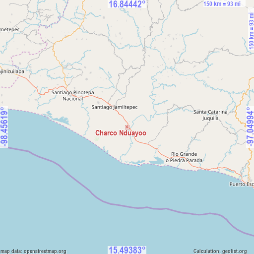
Charco Nduayoo GPS coordinates[2]
16° 10' 13.008" North, 97° 45' 11.016" West
| Map corner | latitude | longitude |
|---|---|---|
| Upper-left | 16.84442°, | -98.45619° |
| Center: | 16.17028°, | -97.75306° |
| Lower-right: | 15.49383°, | -97.04994° |
| Map W x H: | 150.2×150.2 km | = 93.3×93.3mi |
| max Lat: | 32.7° ⇑96.5% North |
| Charco Nduayoo: | 16.17028° |
| min Lat: | ⇓3.5% South 14.53588° |
| min Long | Charco Nduayoo | max Long |
| -117.105° | -97.75306° | -86.73105° |
| W 66.7%⇐ | ⇒33.3% E |
Elevation
Elevation of Charco Nduayoo is 33 m = 108 ft, and this is 1220.7 m = 4005 ft below average elevation for this country.
| Max E: |
3497 m = 11473 ft | 87.2% |
| Avg. | 1253.7 m = 4113 ft | |
| Charco Nduayoo | 33 m = 108 ft | |
Min E: |
-1 m = -3 ft | 12.8% |
See also: Mexico elevation on elevation.city.
Geographical zone
Charco Nduayoo is located in North Torrid zone (between Equator and Tropic of Cancer). Distance of this Northern Tropic circle is 808 km =502.1 mi to North.| Distance of | km | miles | from Charco Nduayoo |
|---|---|---|---|
| North Pole | 8209.1 | 5100.9 | to North |
| Arctic Circle | 5603.2 | 3481.7 | to North |
| Tropic Cancer | 808 | 502.1 | to North |
| Equator | 1798 | 1117.2 | to South |


Nearby cities:
15 places around Charco Nduayoo: (largest is in red/bold)
• El Azufre
20.6 km =12.8 mi,  188°
188°
• Jamiltepec
14.6 km =9.1 mi,  328°
328°
• José María Morelos
19.3 km =12 mi,  281°
281°
• La Luz
17.9 km =11.1 mi,  110°
110°
• Paso de la Reina
19 km =11.8 mi,  61°
61°
• Paso del Jiote
22.6 km =14 mi, 283°
• Patria Nueva
4.9 km =3 mi, 283°
• San José Río Verde (La Boquilla)
3.7 km =2.3 mi,  180°
180°
• San José del Progreso
10.4 km =6.5 mi,  143°
143°
• San Miguel
19.4 km =12.1 mi,  127°
127°
• Santa Catarina Mechoacán
20.5 km =12.7 mi, 334°
• Santa Cruz Tihuixte
19.1 km =11.9 mi,  30°
30°
• Santa Elena Comaltepec
17.2 km =10.7 mi,  343°
343°
• Santa Rosa de Lima
17.7 km =11 mi, 128°
• Santiago Tetepec
16.8 km =10.4 mi,  1°
1°
Sources, notices
• [Note1] Compared only with cities in Mexico existing in our database
• [Src1] Map data: © OpenStreetMap contributors (CC-BY-SA)
• [Src2] Other city data from geonames.org with taken over terms of usage.
• [Src3] Geographical zone / Annual Mean Temperature by Robert A. Rohde @ Wikipedia
