San Cristóbal Honduras geodata
San Cristóbal Honduras (Oaxaca) is a populated place; located in Mexico in America/Mexico_City (GMT-6) time zone. With population of 1,086 people, there are 8018 cities with bigger population in this country. Compared to other cities in Mexico, 95.5% of cities are located further ↑North; 74.3% of cities are located further ←West and 58.3% of cities have higher elevation than San Cristóbal Honduras. Note1


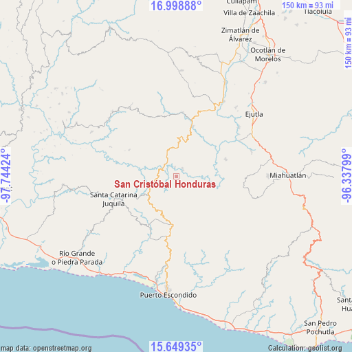
San Cristóbal Honduras GPS coordinates[2]
16° 19' 31.008" North, 97° 2' 27.996" West
| Map corner | latitude | longitude |
|---|---|---|
| Upper-left | 16.99888°, | -97.74424° |
| Center: | 16.32528°, | -97.04111° |
| Lower-right: | 15.64935°, | -96.33799° |
| Map W x H: | 150.1×150.1 km | = 93.3×93.3mi |
| max Lat: | 32.7° ⇑95.5% North |
| San Cristóbal Honduras: | 16.32528° |
| min Lat: | ⇓4.5% South 14.53588° |
| min Long | San Cristóbal | max Long |
| -117.105° | -97.04111° | -86.73105° |
| W 74.3%⇐ | ⇒25.7% E |
Elevation
Elevation of San Cristóbal Honduras is 1090 m = 3576 ft, and this is 163.7 m = 537 ft below average elevation for this country.
| Max E: |
3497 m = 11473 ft | 58.3% |
| Avg. | 1253.7 m = 4113 ft | |
| San Cristóbal Honduras | 1090 m = 3576 ft | |
Min E: |
-1 m = -3 ft | 41.7% |
See also: Mexico elevation on elevation.city.
Geographical zone
San Cristóbal Honduras is located in North Torrid zone (between Equator and Tropic of Cancer). Distance of this Northern Tropic circle is 790.7 km =491.3 mi to North.| Distance of | km | miles | from San Cristóbal Honduras |
|---|---|---|---|
| North Pole | 8191.9 | 5090.2 | to North |
| Arctic Circle | 5586 | 3471 | to North |
| Tropic Cancer | 790.7 | 491.3 | to North |
| Equator | 1815.2 | 1127.9 | to South |


Nearby cities:
15 places around San Cristóbal Honduras: (largest is in red/bold)
• Cañada de Guadalupe
22.4 km =13.9 mi,  214°
214°
• Las Palmas
20.7 km =12.9 mi,  182°
182°
• San Francisco Ixpantepec
22.4 km =13.9 mi,  258°
258°
• San Francisco Sola
22.3 km =13.9 mi,  18°
18°
• San Gabriel Mixtepec
25.9 km =16.1 mi,  189°
189°
• San Jerónimo Coatlán
21 km =13 mi,  119°
119°
• San Juan Lachao
20.5 km =12.7 mi, 205°
• San Pedro Juchaltengo
5.6 km =3.5 mi,  293°
293°
• San Sebastián Coatlán
26.7 km =16.6 mi, 120°
• San Vicente Coatlán
22.2 km =13.8 mi,  71°
71°
• Santa María Temaxcaltepec
24.3 km =15.1 mi,  223°
223°
• Santiago Yaitepec
26.7 km =16.6 mi,  245°
245°
• Santos Reyes Nopala
26.7 km =16.6 mi,  204°
204°
• Soledad Piedra Larga
21.2 km =13.2 mi, 175°
• Villa Sola de Vega
22.5 km =14 mi, 17°
Sources, notices
• [Note1] Compared only with cities in Mexico existing in our database
• [Src1] Map data: © OpenStreetMap contributors (CC-BY-SA)
• [Src2] Other city data from geonames.org with taken over terms of usage.
• [Src3] Geographical zone / Annual Mean Temperature by Robert A. Rohde @ Wikipedia
