El Azufre geodata
El Azufre (Oaxaca) is a populated place; located in Mexico in America/Mexico_City (GMT-6) time zone. With population of 524 people, there are 16113 cities with bigger population in this country. Compared to other cities in Mexico, 97.3% of cities are located further ↑North; 66.3% of cities are located further ←West and 98.7% of cities have higher elevation than El Azufre. Note1


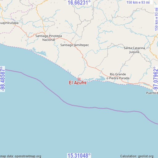
El Azufre GPS coordinates[2]
15° 59' 15.144" North, 97° 46' 57.864" West
| Map corner | latitude | longitude |
|---|---|---|
| Upper-left | 16.66231°, | -98.48587° |
| Center: | 15.98754°, | -97.78274° |
| Lower-right: | 15.31048°, | -97.07962° |
| Map W x H: | 150.3×150.3 km | = 93.4×93.4mi |
| max Lat: | 32.7° ⇑97.3% North |
| El Azufre: | 15.98754° |
| min Lat: | ⇓2.7% South 14.53588° |
| min Long | El Azufre | max Long |
| -117.105° | -97.78274° | -86.73105° |
| W 66.3%⇐ | ⇒33.7% E |
Elevation
Elevation of El Azufre is 7 m = 23 ft, and this is 1246.7 m = 4090 ft below average elevation for this country.
| Max E: |
3497 m = 11473 ft | 98.7% |
| Avg. | 1253.7 m = 4113 ft | |
| El Azufre | 7 m = 23 ft | |
Min E: |
-1 m = -3 ft | 1.3% |
See also: Mexico elevation on elevation.city.
Geographical zone
El Azufre is located in North Torrid zone (between Equator and Tropic of Cancer). Distance of this Northern Tropic circle is 828.3 km =514.7 mi to North.| Distance of | km | miles | from El Azufre |
|---|---|---|---|
| North Pole | 8229.4 | 5113.5 | to North |
| Arctic Circle | 5623.5 | 3494.3 | to North |
| Tropic Cancer | 828.3 | 514.7 | to North |
| Equator | 1777.6 | 1104.5 | to South |


Nearby cities:
15 places around El Azufre: (largest is in red/bold)
• Cerro de la Esperanza
32.7 km =20.3 mi,  320°
320°
• Charco Nduayoo
20.6 km =12.8 mi,  8°
8°
• Collantes
30.1 km =18.7 mi, 317°
• El Zapotalito
24.9 km =15.5 mi,  91°
91°
• Jamiltepec
33.1 km =20.6 mi,  352°
352°
• José María Morelos
28.7 km =17.8 mi,  326°
326°
• La Luz
24.5 km =15.2 mi,  54°
54°
• Paso del Jiote
31.7 km =19.7 mi, 323°
• Patria Nueva
21.6 km =13.4 mi,  355°
355°
• San José Río Verde (La Boquilla)
16.9 km =10.5 mi, 10°
• San José del Progreso
15.3 km =9.5 mi,  38°
38°
• San Miguel
20.5 km =12.7 mi,  65°
65°
• Santa María Acatepec
34 km =21.1 mi,  58°
58°
• Santa María Chico Ometepec
28.6 km =17.8 mi, 316°
• Santa Rosa de Lima
19.4 km =12.1 mi, 61°
Sources, notices
• [Note1] Compared only with cities in Mexico existing in our database
• [Src1] Map data: © OpenStreetMap contributors (CC-BY-SA)
• [Src2] Other city data from geonames.org with taken over terms of usage.
• [Src3] Geographical zone / Annual Mean Temperature by Robert A. Rohde @ Wikipedia
