San Miguel geodata
San Miguel (Oaxaca) is a populated place; located in Mexico in America/Mexico_City (GMT-6) time zone. With population of 533 people, there are 15888 cities with bigger population in this country. Compared to other cities in Mexico, 97.1% of cities are located further ↑North; 68.3% of cities are located further ←West and 88.3% of cities have higher elevation than San Miguel. Note1


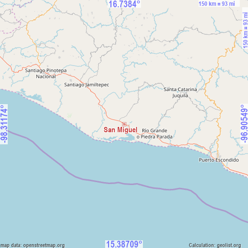
San Miguel GPS coordinates[2]
16° 3' 50.004" North, 97° 36' 30.996" West
| Map corner | latitude | longitude |
|---|---|---|
| Upper-left | 16.7384°, | -98.31174° |
| Center: | 16.06389°, | -97.60861° |
| Lower-right: | 15.38709°, | -96.90549° |
| Map W x H: | 150.3×150.3 km | = 93.4×93.4mi |
| max Lat: | 32.7° ⇑97.1% North |
| San Miguel: | 16.06389° |
| min Lat: | ⇓2.9% South 14.53588° |
| min Long | San Miguel | max Long |
| -117.105° | -97.60861° | -86.73105° |
| W 68.3%⇐ | ⇒31.7% E |
Elevation
Elevation of San Miguel is 29 m = 95 ft, and this is 1224.7 m = 4018 ft below average elevation for this country.
| Max E: |
3497 m = 11473 ft | 88.3% |
| Avg. | 1253.7 m = 4113 ft | |
| San Miguel | 29 m = 95 ft | |
Min E: |
-1 m = -3 ft | 11.7% |
See also: Mexico elevation on elevation.city.
Geographical zone
San Miguel is located in North Torrid zone (between Equator and Tropic of Cancer). Distance of this Northern Tropic circle is 819.8 km =509.4 mi to North.| Distance of | km | miles | from San Miguel |
|---|---|---|---|
| North Pole | 8220.9 | 5108.2 | to North |
| Arctic Circle | 5615 | 3489 | to North |
| Tropic Cancer | 819.8 | 509.4 | to North |
| Equator | 1786.1 | 1109.8 | to South |


Nearby cities:
15 places around San Miguel: (largest is in red/bold)
• Charco Nduayoo
19.4 km =12.1 mi,  307°
307°
• El Azufre
20.5 km =12.7 mi,  245°
245°
• El Zapotalito
11.1 km =6.9 mi,  145°
145°
• La Luz
5.8 km =3.6 mi,  13°
13°
• Paso de la Reina
20.9 km =13 mi,  3°
3°
• Patria Nueva
24 km =14.9 mi,  302°
302°
• Peñas Negras
22.1 km =13.7 mi,  35°
35°
• Río Grande
19.4 km =12.1 mi,  107°
107°
• San José Río Verde (La Boquilla)
17.4 km =10.8 mi, 297°
• San José del Progreso
9.9 km =6.2 mi,  291°
291°
• Santa Ana Tututepec
15.6 km =9.7 mi,  32°
32°
• Santa María Acatepec
13.9 km =8.6 mi,  47°
47°
• Santa Rosa de Lima
1.8 km =1.1 mi, 297°
• Santiago Jocotepec
19.6 km =12.2 mi,  68°
68°
• Tataltepec de Valdés
27.7 km =17.2 mi, 13°
Sources, notices
• [Note1] Compared only with cities in Mexico existing in our database
• [Src1] Map data: © OpenStreetMap contributors (CC-BY-SA)
• [Src2] Other city data from geonames.org with taken over terms of usage.
• [Src3] Geographical zone / Annual Mean Temperature by Robert A. Rohde @ Wikipedia
