Chapultepec geodata
Chapultepec (Oaxaca) is a populated place; located in Mexico in America/Mexico_City (GMT-6) time zone. With population of 675 people, there are 12870 cities with bigger population in this country. Compared to other cities in Mexico, 89.1% of cities are located further ↑North; 68.7% of cities are located further ←West and 91% of cities have lower elevation than Chapultepec. Note1


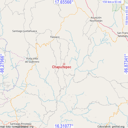
Chapultepec GPS coordinates[2]
16° 59' 3.912" North, 97° 34' 35.508" West
| Map corner | latitude | longitude |
|---|---|---|
| Upper-left | 17.65566°, | -98.27966° |
| Center: | 16.98442°, | -97.57653° |
| Lower-right: | 16.31077°, | -96.87341° |
| Map W x H: | 149.5×149.5 km | = 92.9×92.9mi |
| max Lat: | 32.7° ⇑89.1% North |
| Chapultepec: | 16.98442° |
| min Lat: | ⇓10.9% South 14.53588° |
| min Long | Chapultepec | max Long |
| -117.105° | -97.57653° | -86.73105° |
| W 68.7%⇐ | ⇒31.3% E |
Elevation
Elevation of Chapultepec is 2440 m = 8005 ft, and this is 1186.3 m = 3892 ft above average elevation for this country.
| Max E: |
3497 m = 11473 ft | 9% |
| Chapultepec | 2440 m 8005 ft | |
| Avg. | 1253.7 m = 4113 ft | |
Min E: |
-1 m = -3 ft | 91% |
See also: Mexico elevation on elevation.city.
Geographical zone
Chapultepec is located in North Torrid zone (between Equator and Tropic of Cancer). Distance of this Northern Tropic circle is 717.4 km =445.8 mi to North.| Distance of | km | miles | from Chapultepec |
|---|---|---|---|
| North Pole | 8118.6 | 5044.7 | to North |
| Arctic Circle | 5512.7 | 3425.4 | to North |
| Tropic Cancer | 717.4 | 445.8 | to North |
| Equator | 1888.5 | 1173.5 | to South |


Nearby cities:
15 places around Chapultepec: (largest is in red/bold)
• Agua del Toro
14.9 km =9.3 mi,  273°
273°
• Aldama
2.9 km =1.8 mi,  225°
225°
• Buenavista
15.8 km =9.8 mi,  31°
31°
• Ignacio Zaragoza
6.4 km =4 mi,  333°
333°
• Imperio
7.8 km =4.8 mi,  196°
196°
• Progreso
6.8 km =4.2 mi,  5°
5°
• San Esteban Atatlahuca
14.2 km =8.8 mi,  310°
310°
• San Miguel el Grande Villa Juárez
8.4 km =5.2 mi, 325°
• Santa Catarina Ticuá
10.7 km =6.6 mi,  24°
24°
• Santa Cruz Itundujia
15.2 km =9.4 mi,  215°
215°
• Santa Cruz Tacahua
11.6 km =7.2 mi,  128°
128°
• Santiago Yosondúa
12.1 km =7.5 mi,  179°
179°
• Villa Chalcatongo de Hidalgo
5.4 km =3.4 mi, 6°
• Villa de Guadalupe Victoria
10.2 km =6.3 mi,  339°
339°
• Yutecoso Cuauhtémoc
14.9 km =9.3 mi,  242°
242°
Sources, notices
• [Note1] Compared only with cities in Mexico existing in our database
• [Src1] Map data: © OpenStreetMap contributors (CC-BY-SA)
• [Src2] Other city data from geonames.org with taken over terms of usage.
• [Src3] Geographical zone / Annual Mean Temperature by Robert A. Rohde @ Wikipedia
