Progreso geodata
Progreso (Oaxaca) is a populated place; located in Mexico in America/Mexico_City (GMT-6) time zone. With population of 1,070 people, there are 8156 cities with bigger population in this country. Compared to other cities in Mexico, 88.3% of cities are located further ↑North; 68.7% of cities are located further ←West and 91.5% of cities have lower elevation than Progreso. Note1


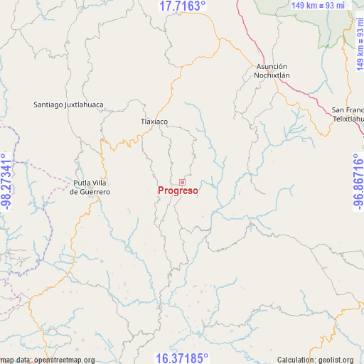
Progreso GPS coordinates[2]
17° 2' 43.008" North, 97° 34' 13.008" West
| Map corner | latitude | longitude |
|---|---|---|
| Upper-left | 17.7163°, | -98.27341° |
| Center: | 17.04528°, | -97.57028° |
| Lower-right: | 16.37185°, | -96.86716° |
| Map W x H: | 149.5×149.5 km | = 92.9×92.9mi |
| max Lat: | 32.7° ⇑88.3% North |
| Progreso: | 17.04528° |
| min Lat: | ⇓11.7% South 14.53588° |
| min Long | Progreso | max Long |
| -117.105° | -97.57028° | -86.73105° |
| W 68.7%⇐ | ⇒31.3% E |
Elevation
Elevation of Progreso is 2460 m = 8071 ft, and this is 1206.3 m = 3958 ft above average elevation for this country.
| Max E: |
3497 m = 11473 ft | 8.5% |
| Progreso | 2460 m 8071 ft | |
| Avg. | 1253.7 m = 4113 ft | |
Min E: |
-1 m = -3 ft | 91.5% |
See also: Mexico elevation on elevation.city.
Geographical zone
Progreso is located in North Torrid zone (between Equator and Tropic of Cancer). Distance of this Northern Tropic circle is 710.7 km =441.6 mi to North.| Distance of | km | miles | from Progreso |
|---|---|---|---|
| North Pole | 8111.8 | 5040.4 | to North |
| Arctic Circle | 5505.9 | 3421.2 | to North |
| Tropic Cancer | 710.7 | 441.6 | to North |
| Equator | 1895.3 | 1177.7 | to South |


Nearby cities:
15 places around Progreso: (largest is in red/bold)
• Agua del Toro
16.6 km =10.3 mi,  249°
249°
• Aldama
9.2 km =5.7 mi,  197°
197°
• Buenavista
10.1 km =6.3 mi,  48°
48°
• Chapultepec
6.8 km =4.2 mi,  185°
185°
• Ignacio Zaragoza
3.6 km =2.2 mi, 253°
• Imperio
14.5 km =9 mi, 191°
• Llano de Guadalupe
14.7 km =9.1 mi,  337°
337°
• San Esteban Atatlahuca
11.7 km =7.3 mi,  281°
281°
• San Mateo Peñasco
12.4 km =7.7 mi,  18°
18°
• San Miguel el Grande Villa Juárez
5.5 km =3.4 mi,  271°
271°
• San Pedro el Alto
16.4 km =10.2 mi, 45°
• Santa Catarina Ticuá
4.8 km =3 mi, 51°
• Santa Cruz Tacahua
16.3 km =10.1 mi,  149°
149°
• Villa Chalcatongo de Hidalgo
1.4 km =0.9 mi,  181°
181°
• Villa de Guadalupe Victoria
5.1 km =3.2 mi,  302°
302°
Sources, notices
• [Note1] Compared only with cities in Mexico existing in our database
• [Src1] Map data: © OpenStreetMap contributors (CC-BY-SA)
• [Src2] Other city data from geonames.org with taken over terms of usage.
• [Src3] Geographical zone / Annual Mean Temperature by Robert A. Rohde @ Wikipedia
