Villa Chalcatongo de Hidalgo geodata
Villa Chalcatongo de Hidalgo (Oaxaca) is a populated place; located in Mexico in America/Mexico_City (GMT-6) time zone. With population of 2,447 people, there are 3610 cities with bigger population in this country. Compared to other cities in Mexico, 88.4% of cities are located further ↑North; 68.7% of cities are located further ←West and 91.9% of cities have lower elevation than Villa Chalcatongo de Hidalgo. Note1
Current local time in Villa Chalcatongo de Hidalgo:
11:17 AM, MondayDifference from your time zone: hours


Villa Chalcatongo de Hidalgo GPS coordinates[2]
17° 1' 56.892" North, 97° 34' 14.052" West
| Map corner | latitude | longitude |
|---|---|---|
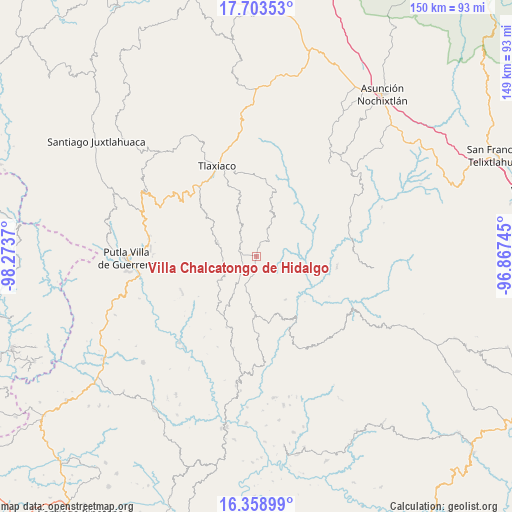
| Upper-left | 17.70353°, | -98.2737° |
| Center: | 17.03247°, | -97.57057° |
| Lower-right: | 16.35899°, | -96.86745° |
| Map W x H: | 149.5×149.5 km | = 92.9×92.9mi |
| max Lat: | 32.7° ⇑88.4% North |
| Villa Chalcatongo de Hidalgo: | 17.03247° |
| min Lat: | ⇓11.6% South 14.53588° |
| min Long | Villa Chalcaton | max Long |
| -117.105° | -97.57057° | -86.73105° |
| W 68.7%⇐ | ⇒31.3% E |
Elevation
Elevation of Villa Chalcatongo de Hidalgo is 2478 m = 8130 ft, and this is 1224.3 m = 4017 ft above average elevation for this country.
| Max E: |
3497 m = 11473 ft | 8.1% |
| Villa Chalcatongo de Hidalgo | 2478 m 8130 ft | |
| Avg. | 1253.7 m = 4113 ft | |
Min E: |
-1 m = -3 ft | 91.9% |
See also: Mexico elevation on elevation.city.
Geographical zone
Villa Chalcatongo de Hidalgo is located in North Torrid zone (between Equator and Tropic of Cancer). Distance of this Northern Tropic circle is 712.1 km =442.5 mi to North.| Distance of | km | miles | from Villa Chalcatongo de Hidalgo |
|---|---|---|---|
| North Pole | 8113.2 | 5041.3 | to North |
| Arctic Circle | 5507.3 | 3422.1 | to North |
| Tropic Cancer | 712.1 | 442.5 | to North |
| Equator | 1893.8 | 1176.8 | to South |


Nearby cities:
15 places around Villa Chalcatongo de Hidalgo: (largest is in red/bold)
• Agua del Toro
16.1 km =10 mi,  253°
253°
• Aldama
7.9 km =4.9 mi,  200°
200°
• Buenavista
11.2 km =7 mi,  43°
43°
• Chapultepec
5.4 km =3.4 mi,  186°
186°
• Ignacio Zaragoza
3.5 km =2.2 mi,  276°
276°
• Imperio
13.1 km =8.1 mi, 192°
• Llano de Guadalupe
16.1 km =10 mi,  339°
339°
• Progreso
1.4 km =0.9 mi,  1°
1°
• San Esteban Atatlahuca
12.1 km =7.5 mi,  288°
288°
• San Mateo Peñasco
13.8 km =8.6 mi,  16°
16°
• San Miguel el Grande Villa Juárez
5.7 km =3.5 mi, 286°
• Santa Catarina Ticuá
5.8 km =3.6 mi, 40°
• Santa Cruz Tacahua
15.1 km =9.4 mi,  146°
146°
• Santiago Yosondúa
17.4 km =10.8 mi,  181°
181°
• Villa de Guadalupe Victoria
5.9 km =3.7 mi,  314°
314°
Sources, notices
• [Note1] Compared only with cities in Mexico existing in our database
• [Src1] Map data: © OpenStreetMap contributors (CC-BY-SA)
• [Src2] Other city data from geonames.org with taken over terms of usage.
• [Src3] Geographical zone / Annual Mean Temperature by Robert A. Rohde @ Wikipedia
