La Reforma San Mateo geodata
La Reforma San Mateo (Oaxaca) is a populated place; located in Mexico in America/Mexico_City (GMT-6) time zone. With population of 685 people, there are 12680 cities with bigger population in this country. Compared to other cities in Mexico, 77.2% of cities are located further ↑North; 76.4% of cities are located further ←West and 54.1% of cities have lower elevation than La Reforma San Mateo. Note1
Current local time in La Reforma San Mateo:
08:34 AM, WednesdayDifference from your time zone: hours


La Reforma San Mateo GPS coordinates[2]
18° 7' 55.992" North, 96° 52' 10.992" West
| Map corner | latitude | longitude |
|---|---|---|
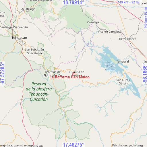
| Upper-left | 18.79914°, | -97.57285° |
| Center: | 18.13222°, | -96.86972° |
| Lower-right: | 17.46275°, | -96.1666° |
| Map W x H: | 148.6×148.6 km | = 92.3×92.3mi |
| max Lat: | 32.7° ⇑77.2% North |
| La Reforma San Mateo: | 18.13222° |
| min Lat: | ⇓22.8% South 14.53588° |
| min Long | La Reforma San | max Long |
| -117.105° | -96.86972° | -86.73105° |
| W 76.4%⇐ | ⇒23.6% E |
Elevation
Elevation of La Reforma San Mateo is 1565 m = 5135 ft, and this is 311.3 m = 1021 ft above average elevation for this country.
| Max E: |
3497 m = 11473 ft | 45.9% |
| La Reforma San Mateo | 1565 m 5135 ft | |
| Avg. | 1253.7 m = 4113 ft | |
Min E: |
-1 m = -3 ft | 54.1% |
See also: Mexico elevation on elevation.city.
Geographical zone
La Reforma San Mateo is located in North Torrid zone (between Equator and Tropic of Cancer). Distance of this Northern Tropic circle is 589.8 km =366.5 mi to North.| Distance of | km | miles | from La Reforma San Mateo |
|---|---|---|---|
| North Pole | 7990.9 | 4965.3 | to North |
| Arctic Circle | 5385.1 | 3346.1 | to North |
| Tropic Cancer | 589.8 | 366.5 | to North |
| Equator | 2016.1 | 1252.7 | to South |


Nearby cities:
15 places around La Reforma San Mateo: (largest is in red/bold)
• El Carrizal
3.4 km =2.1 mi,  158°
158°
• Eloxochitlán de Flores Magón
5 km =3.1 mi,  353°
353°
• Huautla de Jiménez
3 km =1.9 mi,  91°
91°
• Llano de Agua
6.9 km =4.3 mi,  115°
115°
• Loma Chapultepec
3.5 km =2.2 mi,  113°
113°
• Loma Chilar
4.6 km =2.9 mi,  76°
76°
• San Andrés Hidalgo
6.8 km =4.2 mi, 85°
• San Isidro Zoquiápam
7.1 km =4.4 mi,  237°
237°
• San Jerónimo Tecóatl
5.9 km =3.7 mi,  309°
309°
• San Lucas Zoquiápam
3.8 km =2.4 mi,  277°
277°
• San Mateo Yoloxochitlán
1.2 km =0.7 mi,  5°
5°
• Santa Cruz Acatepec
3.5 km =2.2 mi, 350°
• Santa Cruz de Juárez
4.2 km =2.6 mi,  60°
60°
• Santa María la Asunción
6 km =3.7 mi, 117°
• Xochitonalco
4.8 km =3 mi,  151°
151°
Sources, notices
• [Note1] Compared only with cities in Mexico existing in our database
• [Src1] Map data: © OpenStreetMap contributors (CC-BY-SA)
• [Src2] Other city data from geonames.org with taken over terms of usage.
• [Src3] Geographical zone / Annual Mean Temperature by Robert A. Rohde @ Wikipedia
