Ahuatitla geodata
Ahuatitla (Hidalgo) is a populated place; located in Mexico in America/Mexico_City (GMT-6) time zone. With population of 3,710 people, there are 2475 cities with bigger population in this country. Compared to other cities in Mexico, 78.8% of cities are located further ↓South; 55.5% of cities are located further ←West and 74.8% of cities have higher elevation than Ahuatitla. Note1


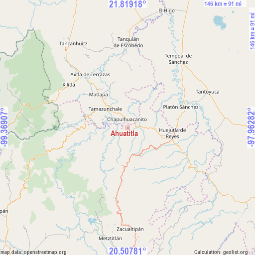
Ahuatitla GPS coordinates[2]
21° 9' 53.82" North, 98° 39' 57.384" West
| Map corner | latitude | longitude |
|---|---|---|
| Upper-left | 21.81918°, | -99.36907° |
| Center: | 21.16495°, | -98.66594° |
| Lower-right: | 20.50781°, | -97.96282° |
| Map W x H: | 145.8×145.8 km | = 90.6×90.6mi |
| max Lat: | 32.7° ⇑21.2% North |
| Ahuatitla: | 21.16495° |
| min Lat: | ⇓78.8% South 14.53588° |
| min Long | Ahuatitla | max Long |
| -117.105° | -98.66594° | -86.73105° |
| W 55.5%⇐ | ⇒44.5% E |
Elevation
Elevation of Ahuatitla is 227 m = 745 ft, and this is 1026.7 m = 3368 ft below average elevation for this country.
| Max E: |
3497 m = 11473 ft | 74.8% |
| Avg. | 1253.7 m = 4113 ft | |
| Ahuatitla | 227 m = 745 ft | |
Min E: |
-1 m = -3 ft | 25.2% |
See also: Mexico elevation on elevation.city.
Geographical zone
Ahuatitla is located in North Torrid zone (between Equator and Tropic of Cancer). Distance of this Northern Tropic circle is 252.6 km =157 mi to North.| Distance of | km | miles | from Ahuatitla |
|---|---|---|---|
| North Pole | 7653.7 | 4755.8 | to North |
| Arctic Circle | 5047.9 | 3136.6 | to North |
| Tropic Cancer | 252.6 | 157 | to North |
| Equator | 2353.3 | 1462.3 | to South |


Nearby cities:
15 places around Ahuatitla: (largest is in red/bold)
• Chantasco
8.7 km =5.4 mi,  273°
273°
• Chapulhuacanito
4.9 km =3 mi,  354°
354°
• Cojolapa
7.6 km =4.7 mi,  327°
327°
• Cuatlimax
7.5 km =4.7 mi,  177°
177°
• Huitzitzilingo
1.3 km =0.8 mi,  46°
46°
• Jalpa
7.9 km =4.9 mi,  218°
218°
• Pahuayo
4.3 km =2.7 mi,  283°
283°
• Pueblo Hidalgo
5.8 km =3.6 mi,  192°
192°
• Rancho Nuevo
7.4 km =4.6 mi,  301°
301°
• San Felipe Orizatlán
6.1 km =3.8 mi,  83°
83°
• Santa Lucía
4.2 km =2.6 mi, 266°
• Talol
6.4 km =4 mi,  140°
140°
• Temango
4.5 km =2.8 mi,  214°
214°
• Tianguispicula
5 km =3.1 mi, 304°
• Totonicapa
7.3 km =4.5 mi,  96°
96°
Sources, notices
• [Note1] Compared only with cities in Mexico existing in our database
• [Src1] Map data: © OpenStreetMap contributors (CC-BY-SA)
• [Src2] Other city data from geonames.org with taken over terms of usage.
• [Src3] Geographical zone / Annual Mean Temperature by Robert A. Rohde @ Wikipedia
