Ámaxac geodata
Ámaxac (Hidalgo) is a populated place; located in Mexico in America/Mexico_City (GMT-6) time zone. With population of 609 people, there are 14153 cities with bigger population in this country. Compared to other cities in Mexico, 79.3% of cities are located further ↓South; 57.6% of cities are located further ←West and 78.5% of cities have higher elevation than Ámaxac. Note1


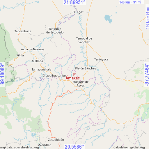
Ámaxac GPS coordinates[2]
21° 12' 55.836" North, 98° 28' 39.936" West
| Map corner | latitude | longitude |
|---|---|---|
| Upper-left | 21.86951°, | -99.18089° |
| Center: | 21.21551°, | -98.47776° |
| Lower-right: | 20.5586°, | -97.77464° |
| Map W x H: | 145.8×145.8 km | = 90.6×90.6mi |
| max Lat: | 32.7° ⇑20.7% North |
| Ámaxac: | 21.21551° |
| min Lat: | ⇓79.3% South 14.53588° |
| min Long | Ámaxac | max Long |
| -117.105° | -98.47776° | -86.73105° |
| W 57.6%⇐ | ⇒42.4% E |
Elevation
Elevation of Ámaxac is 120 m = 394 ft, and this is 1133.7 m = 3719 ft below average elevation for this country.
| Max E: |
3497 m = 11473 ft | 78.5% |
| Avg. | 1253.7 m = 4113 ft | |
| Ámaxac | 120 m = 394 ft | |
Min E: |
-1 m = -3 ft | 21.5% |
See also: Mexico elevation on elevation.city.
Geographical zone
Ámaxac is located in North Torrid zone (between Equator and Tropic of Cancer). Distance of this Northern Tropic circle is 247 km =153.5 mi to North.| Distance of | km | miles | from Ámaxac |
|---|---|---|---|
| North Pole | 7648.1 | 4752.3 | to North |
| Arctic Circle | 5042.2 | 3133.1 | to North |
| Tropic Cancer | 247 | 153.5 | to North |
| Equator | 2358.9 | 1465.8 | to South |


Nearby cities:
15 places around Ámaxac: (largest is in red/bold)
• Chalma
8.3 km =5.2 mi,  95°
95°
• Chiconamel
2.5 km =1.6 mi,  47°
47°
• Cochiscuatitla
7.7 km =4.8 mi,  261°
261°
• Contepec
9 km =5.6 mi,  188°
188°
• Cruztitla
5 km =3.1 mi,  305°
305°
• El Pintor
9.2 km =5.7 mi,  132°
132°
• Hueynali
7.9 km =4.9 mi,  163°
163°
• La Capilla
8.6 km =5.3 mi,  214°
214°
• Las Chacas
5 km =3.1 mi, 263°
• Panacaxtlán
7.8 km =4.8 mi, 162°
• San Pedro Coyutla
5 km =3.1 mi,  79°
79°
• Santa Cruz
2.6 km =1.6 mi,  220°
220°
• Tancazahuela
5.7 km =3.5 mi, 129°
• Zitlán
5.7 km =3.5 mi, 185°
• Zohuala
1.9 km =1.2 mi,  337°
337°
Sources, notices
• [Note1] Compared only with cities in Mexico existing in our database
• [Src1] Map data: © OpenStreetMap contributors (CC-BY-SA)
• [Src2] Other city data from geonames.org with taken over terms of usage.
• [Src3] Geographical zone / Annual Mean Temperature by Robert A. Rohde @ Wikipedia
