San Pedro Coyutla geodata
San Pedro Coyutla (Veracruz) is a populated place; located in Mexico in America/Mexico_City (GMT-6) time zone. With population of 1,123 people, there are 7722 cities with bigger population in this country. Compared to other cities in Mexico, 79.4% of cities are located further ↓South; 58.2% of cities are located further ←West and 76.1% of cities have higher elevation than San Pedro Coyutla. Note1


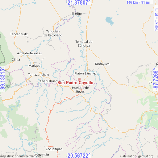
San Pedro Coyutla GPS coordinates[2]
21° 13' 26.76" North, 98° 25' 48.072" West
| Map corner | latitude | longitude |
|---|---|---|
| Upper-left | 21.87807°, | -99.13315° |
| Center: | 21.2241°, | -98.43002° |
| Lower-right: | 20.56722°, | -97.7269° |
| Map W x H: | 145.8×145.8 km | = 90.6×90.6mi |
| max Lat: | 32.7° ⇑20.6% North |
| San Pedro Coyutla: | 21.2241° |
| min Lat: | ⇓79.4% South 14.53588° |
| min Long | San Pedro Coyut | max Long |
| -117.105° | -98.43002° | -86.73105° |
| W 58.2%⇐ | ⇒41.8% E |
Elevation
Elevation of San Pedro Coyutla is 182 m = 597 ft, and this is 1071.7 m = 3516 ft below average elevation for this country.
| Max E: |
3497 m = 11473 ft | 76.1% |
| Avg. | 1253.7 m = 4113 ft | |
| San Pedro Coyutla | 182 m = 597 ft | |
Min E: |
-1 m = -3 ft | 23.9% |
See also: Mexico elevation on elevation.city.
Geographical zone
San Pedro Coyutla is located in North Torrid zone (between Equator and Tropic of Cancer). Distance of this Northern Tropic circle is 246 km =152.9 mi to North.| Distance of | km | miles | from San Pedro Coyutla |
|---|---|---|---|
| North Pole | 7647.2 | 4751.7 | to North |
| Arctic Circle | 5041.3 | 3132.5 | to North |
| Tropic Cancer | 246 | 152.9 | to North |
| Equator | 2359.9 | 1466.4 | to South |


Nearby cities:
15 places around San Pedro Coyutla: (largest is in red/bold)
• Chalma
3.7 km =2.3 mi,  117°
117°
• Chiconamel
3.2 km =2 mi,  282°
282°
• Corral Blanco (Todos por Hidalgo)
9 km =5.6 mi,  151°
151°
• El Pintor
7.4 km =4.6 mi,  166°
166°
• Hueynali
8.9 km =5.5 mi,  197°
197°
• Las Pilas
7.8 km =4.8 mi,  160°
160°
• Motoltepec
9.1 km =5.7 mi,  133°
133°
• Panacaxtlán
8.8 km =5.5 mi, 197°
• Parque de Poblamiento Solidaridad
9.2 km =5.7 mi, 150°
• Platón Sánchez
7.8 km =4.8 mi,  47°
47°
• Santa Cruz
7.2 km =4.5 mi,  246°
246°
• Tancazahuela
4.6 km =2.9 mi,  186°
186°
• Zitlán
8.6 km =5.3 mi,  219°
219°
• Zohuala
5.8 km =3.6 mi, 278°
• Ámaxac
5 km =3.1 mi,  259°
259°
Sources, notices
• [Note1] Compared only with cities in Mexico existing in our database
• [Src1] Map data: © OpenStreetMap contributors (CC-BY-SA)
• [Src2] Other city data from geonames.org with taken over terms of usage.
• [Src3] Geographical zone / Annual Mean Temperature by Robert A. Rohde @ Wikipedia
