Chalma geodata
Chalma (Veracruz) is a seat of a second-order administrative division; located in Mexico in America/Mexico_City (GMT-6) time zone. With population of 2,646 people, there are 3335 cities with bigger population in this country. Compared to other cities in Mexico, 79.2% of cities are located further ↓South; 58.6% of cities are located further ←West and 77.1% of cities have higher elevation than Chalma. Note1


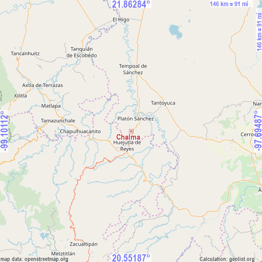
Chalma GPS coordinates[2]
21° 12' 31.716" North, 98° 23' 52.764" West
| Map corner | latitude | longitude |
|---|---|---|
| Upper-left | 21.86284°, | -99.10112° |
| Center: | 21.20881°, | -98.39799° |
| Lower-right: | 20.55187°, | -97.69487° |
| Map W x H: | 145.8×145.8 km | = 90.6×90.6mi |
| max Lat: | 32.7° ⇑20.8% North |
| Chalma: | 21.20881° |
| min Lat: | ⇓79.2% South 14.53588° |
| min Long | Chalma | max Long |
| -117.105° | -98.39799° | -86.73105° |
| W 58.6%⇐ | ⇒41.4% E |
Elevation
Elevation of Chalma is 150 m = 492 ft, and this is 1103.7 m = 3621 ft below average elevation for this country.
| Max E: |
3497 m = 11473 ft | 77.1% |
| Avg. | 1253.7 m = 4113 ft | |
| Chalma | 150 m = 492 ft | |
Min E: |
-1 m = -3 ft | 22.9% |
See also: Mexico elevation on elevation.city.
Geographical zone
Chalma is located in North Torrid zone (between Equator and Tropic of Cancer). Distance of this Northern Tropic circle is 247.7 km =153.9 mi to North.| Distance of | km | miles | from Chalma |
|---|---|---|---|
| North Pole | 7648.9 | 4752.8 | to North |
| Arctic Circle | 5043 | 3133.6 | to North |
| Tropic Cancer | 247.7 | 153.9 | to North |
| Equator | 2358.2 | 1465.3 | to South |


Nearby cities:
15 places around Chalma: (largest is in red/bold)
• Chalahuiyapa
7.3 km =4.5 mi,  151°
151°
• Chiconamel
6.9 km =4.3 mi,  290°
290°
• Chililico
9.1 km =5.7 mi,  205°
205°
• Corral Blanco (Todos por Hidalgo)
6.2 km =3.9 mi,  170°
170°
• El Pintor
5.7 km =3.5 mi,  195°
195°
• Huejutla de Reyes
8 km =5 mi, 196°
• Las Pilas
5.7 km =3.5 mi,  186°
186°
• Los Otates
8.4 km =5.2 mi,  140°
140°
• Motoltepec
5.7 km =3.5 mi, 144°
• Panacaxtlán
8.9 km =5.5 mi,  221°
221°
• Parque de Poblamiento Solidaridad
6.4 km =4 mi, 168°
• Platón Sánchez
7.4 km =4.6 mi,  19°
19°
• San Pedro Coyutla
3.7 km =2.3 mi,  297°
297°
• Tancazahuela
4.8 km =3 mi,  233°
233°
• Ámaxac
8.3 km =5.2 mi,  275°
275°
Sources, notices
• [Note1] Compared only with cities in Mexico existing in our database
• [Src1] Map data: © OpenStreetMap contributors (CC-BY-SA)
• [Src2] Other city data from geonames.org with taken over terms of usage.
• [Src3] Geographical zone / Annual Mean Temperature by Robert A. Rohde @ Wikipedia
